


 13
13

 next time he posts the bust emoji in a target area.
 2
2

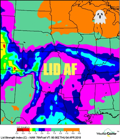
 in time but nope. It's late there as well. This thing likely stays capped or storms stay weak if what is progged remains.
 3
3
 6
6


 5
5


 13
13

 7
7


 3
3
 1
1


 1
1


 2
2
 2
3
2
3


 1
1
 3
2
3
2


 6
4
7
9
6
4
7
9
 7
7


 6
6


 5
5
7
2
for this?! It’s his outlook ffs
6
5
5
7
2
for this?! It’s his outlook ffs
6


 5
4
5
4

 4
4


 3
3
 1
1
 8
8
 8
8

 2
2


 2
2
2
2


 2
2


 1
1


 1
1


 2
1
2
1


