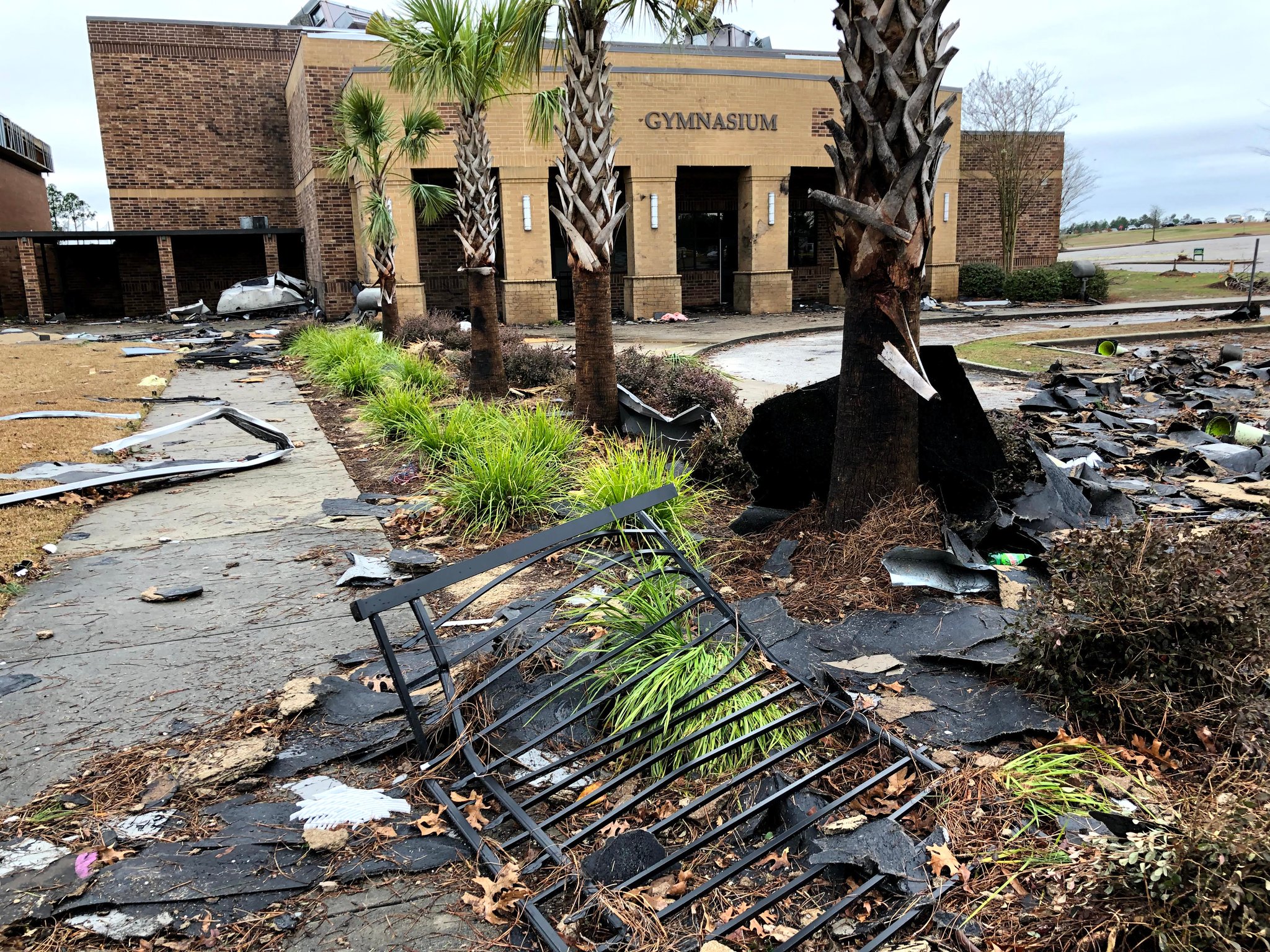


 5
6
5
6


 6
6
 4
4
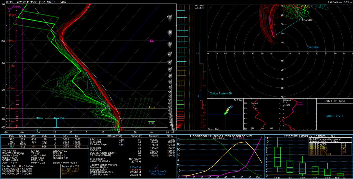
 6
6


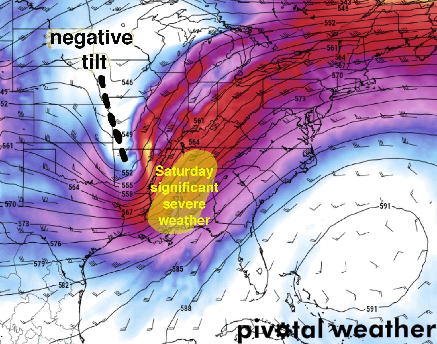
 8
8
 3
3
 3
3
 3
3