9
9


 ready, because this will be interesting.
(edited)
ready, because this will be interesting.
(edited)

 3
3

 6
6

 10
10


 z (Minneapolis, MN)Today at 7:23 PM
I don't understand how the hype isn't even higher for tomorrow
tomorrow is dangerous
2
z (Minneapolis, MN)Today at 7:23 PM
I don't understand how the hype isn't even higher for tomorrow
tomorrow is dangerous
2
 2
2
 9
9


 smile
smile 


 9
9


 #teamworkmakesthe...


 z (Minneapolis, MN)Last Sunday at 7:08 PM
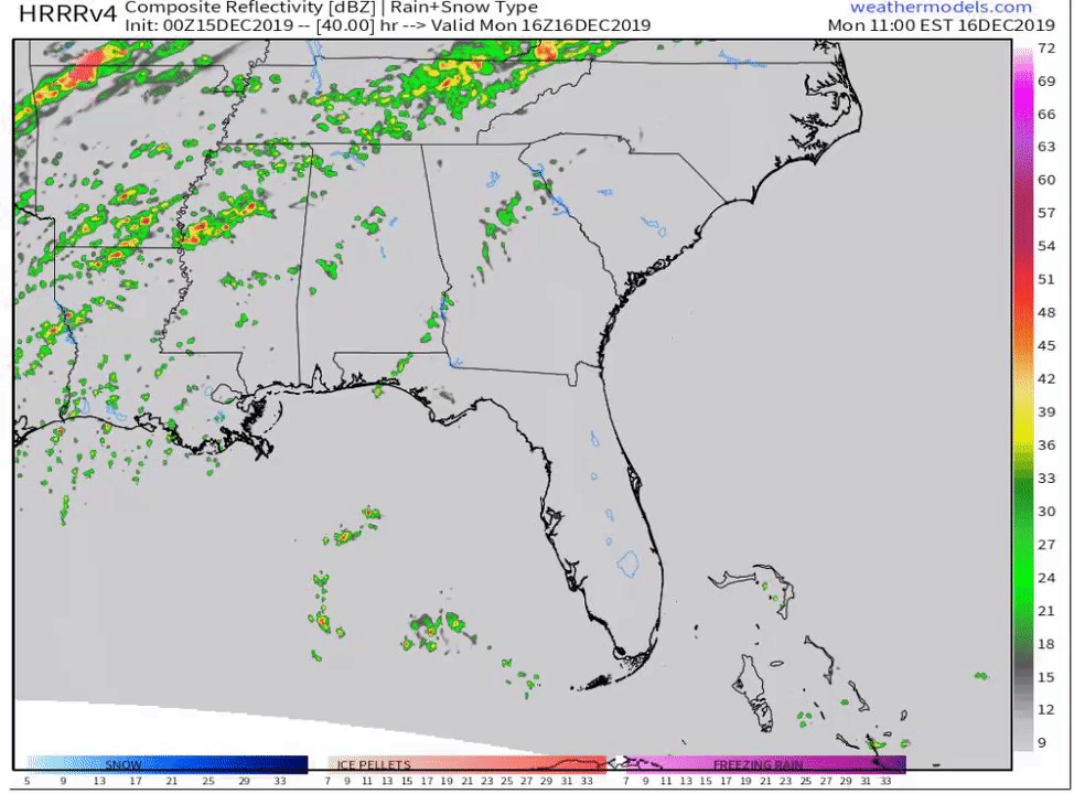
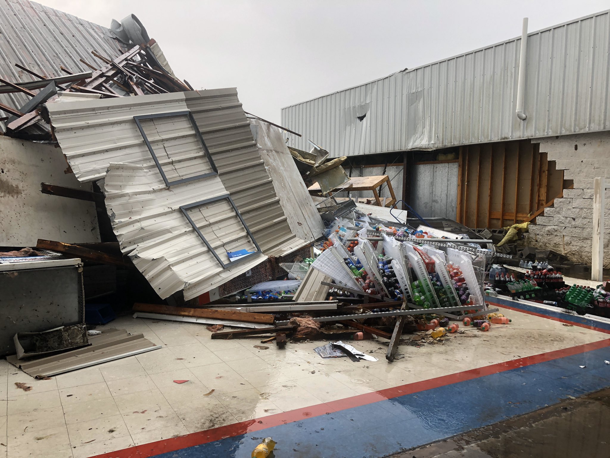
no, tomorrow is legit
there's a lot to like about tomorrow and there could be multipe significant tornadoes
Glen Heinz (Greenville, SC)Last Sunday at 7:10 PM
ok, i see a bit of veer. but that's a legit sounding.
Mike Maz (Minneapolis, MN)Last Sunday at 7:23 PM
I don't understand how the hype isn't even higher for tomorrow
tomorrow is dangerous
z (Minneapolis, MN)Last Sunday at 7:08 PM
no, tomorrow is legit
there's a lot to like about tomorrow and there could be multipe significant tornadoes
Glen Heinz (Greenville, SC)Last Sunday at 7:10 PM
ok, i see a bit of veer. but that's a legit sounding.
Mike Maz (Minneapolis, MN)Last Sunday at 7:23 PM
I don't understand how the hype isn't even higher for tomorrow
tomorrow is dangerous