13
13
 3
3


 that dryline making it into IL has been showing up across the models for days now.


 9
9


 18
18
 17
17
 there has been a ton of model consistency on this so far


 2
2


 14
14
 12
10
12
10
 8
15
8
15
 14
14
 14
14
 14
14
 14
9
11
14
9
11
 1
1


 6
6
 16
16
 15
15
 2
2
 2
2
 18
18


 All the parameters seems Maxed out.. lol it’s ridiculous..
 4
4

 6
6


 9
9
 9
9

 16
16

 1
1
 2
2


 1
1


 4
4

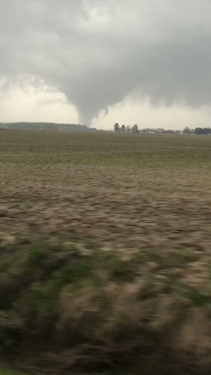
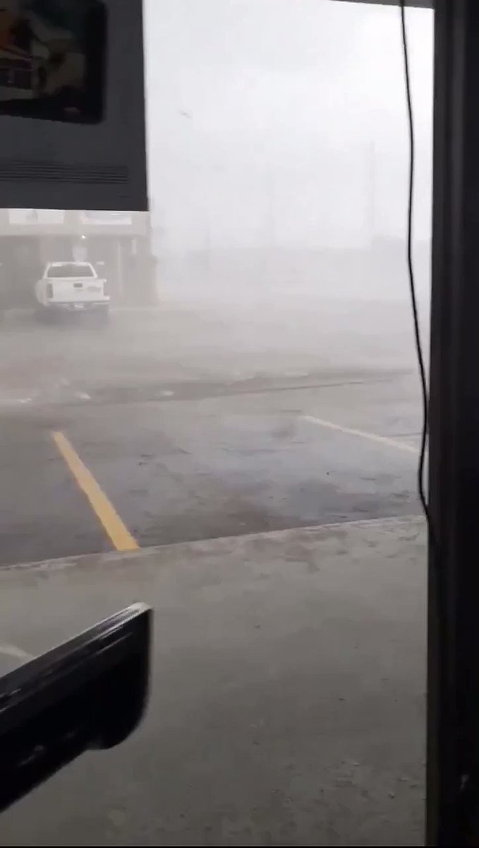
 Chilling a little east of macomb rn. Trying to dodge the
  patches out here.


 10
10


 8
8


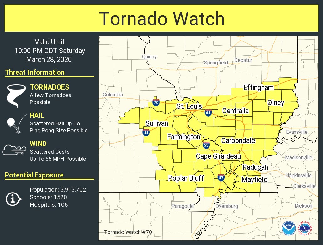
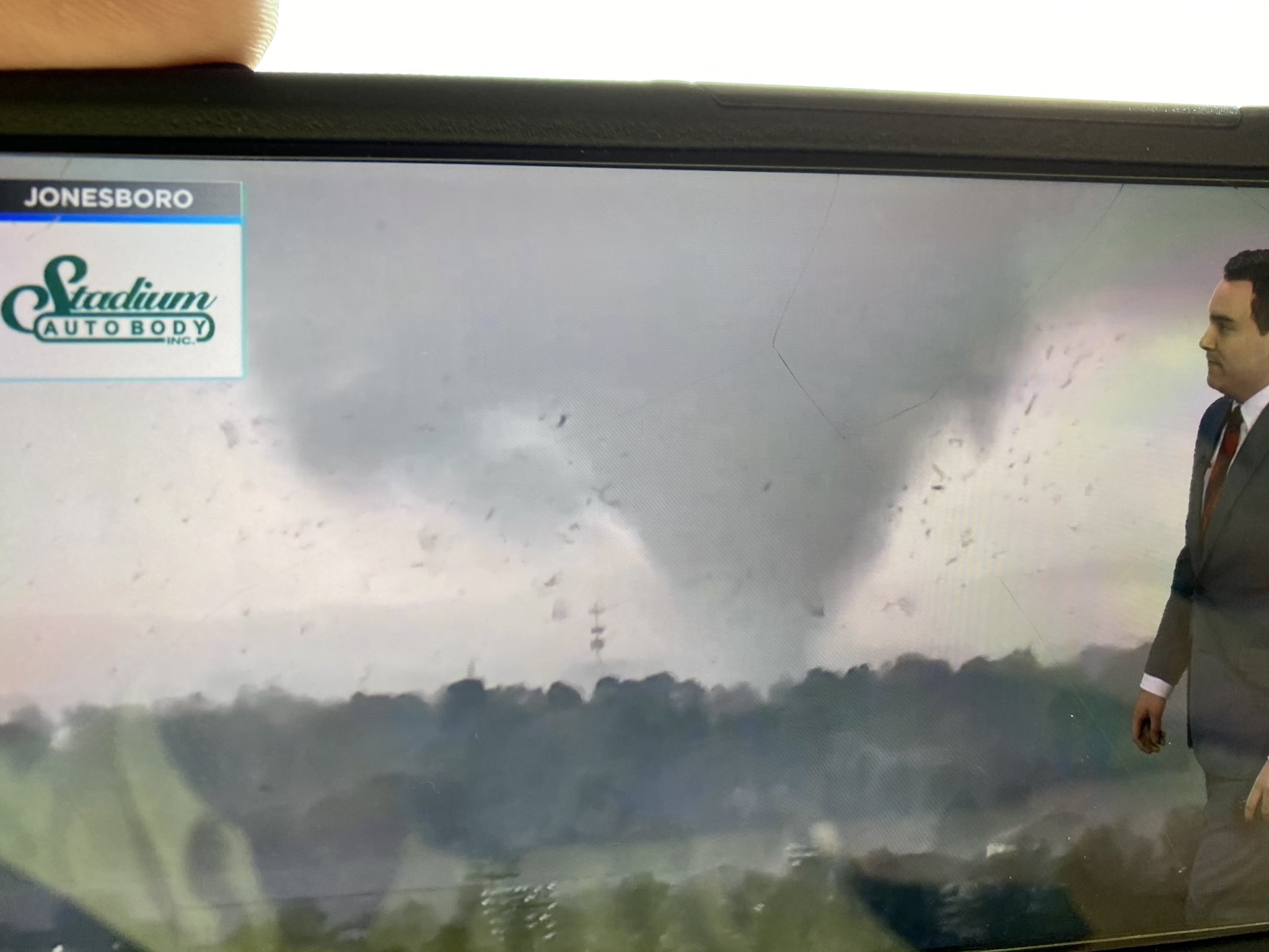
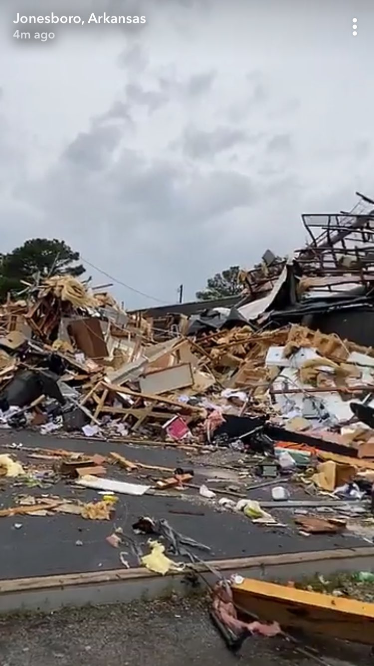
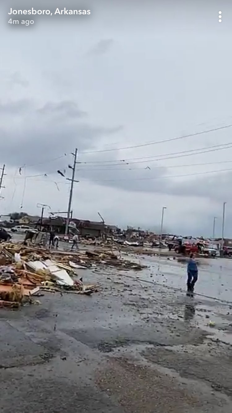
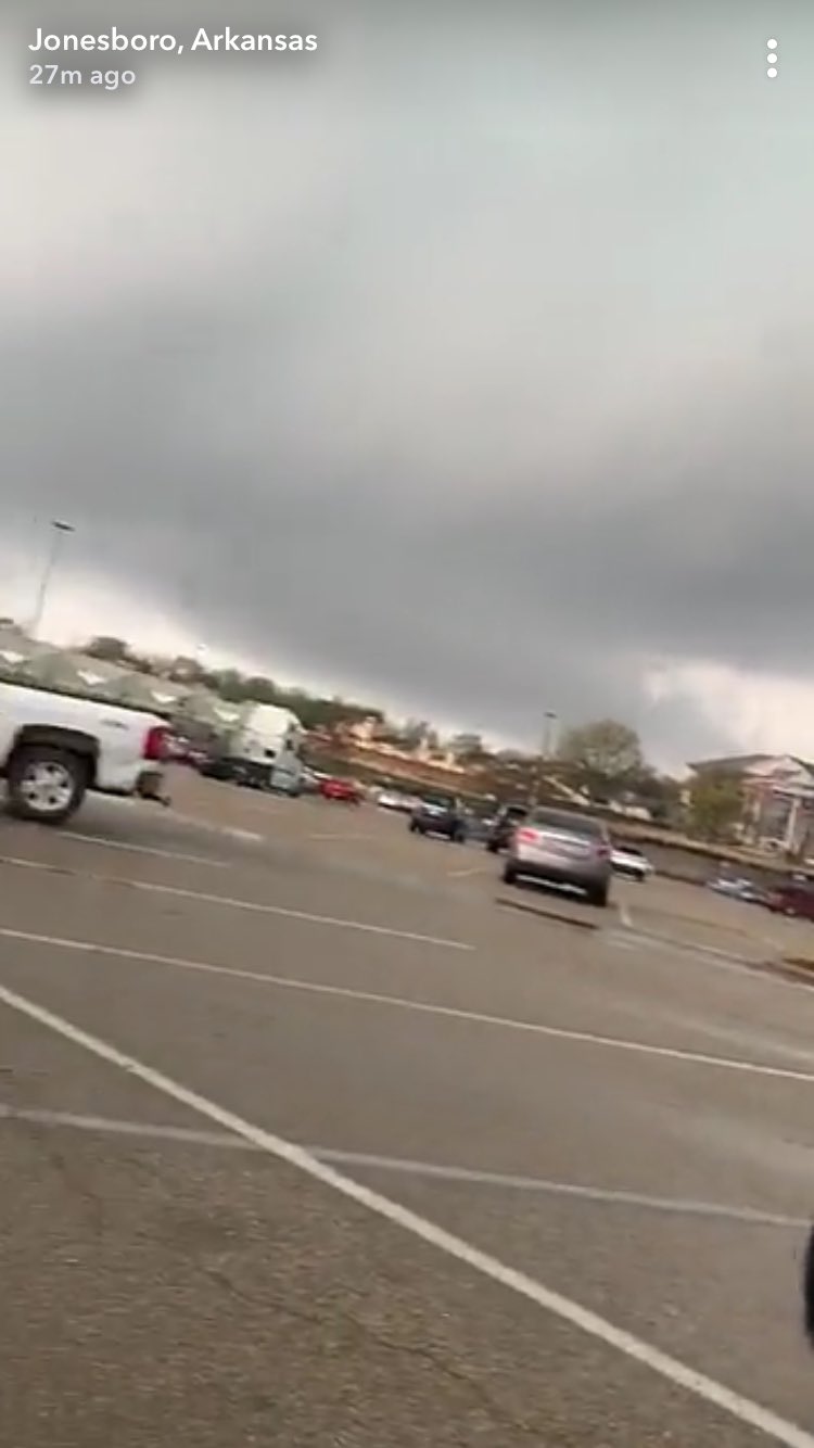
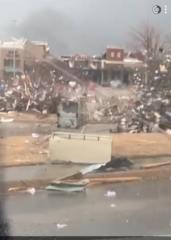
 ️ NEW VIDEO: Watch as a #tornado passed near Paragould, #Arkansas on Saturday evening. #ARwx ️ https://t.co/1Y1Mdn2X8M
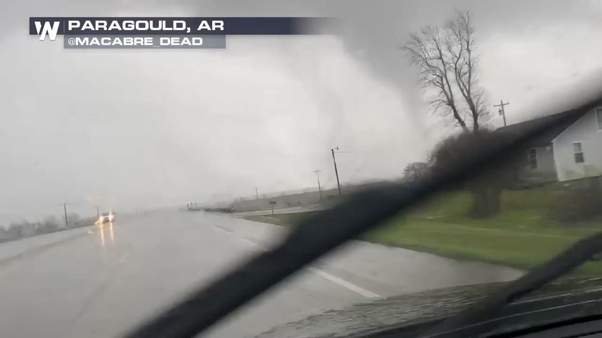 1
1