4
4
 5
5


 15
15
 9
9
 10
10
 8
8

 2
2
 2
2
 ️
️


 9
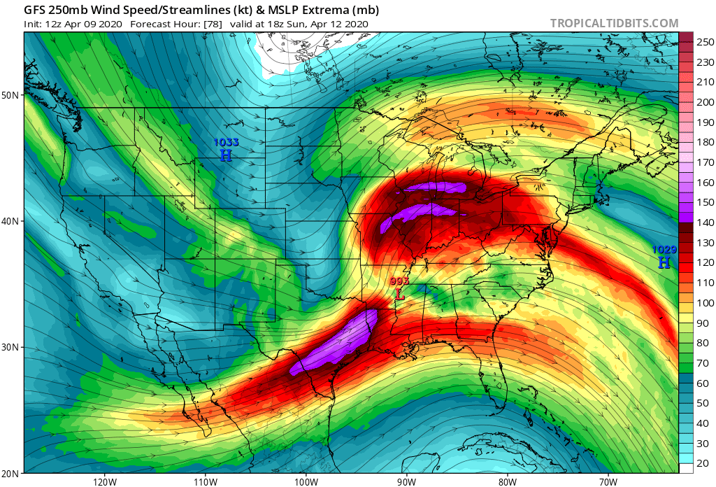
that's an ENSEMBLE... FOUR DAYS out... SHOWING THAT
9
that's an ENSEMBLE... FOUR DAYS out... SHOWING THAT


 1
1


 7
7


 16
16
 14
14
 12
12
 10
7
10
7


 11
11
 6
11
6
11
 2
2
 2
2


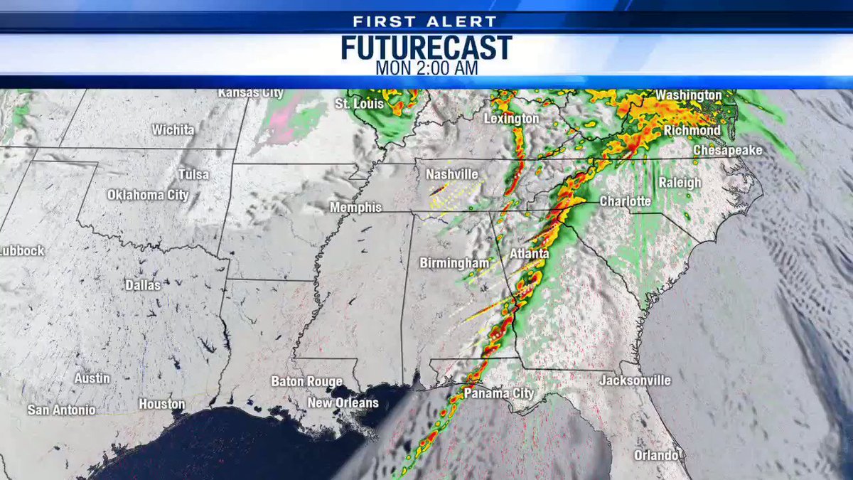
 model painting some bad news for Dixie https://twitter.com/Whitleyweather/status/1248701961559572481
(edited)
model painting some bad news for Dixie https://twitter.com/Whitleyweather/status/1248701961559572481
(edited)
 8
8


 I know. I'm staring at it. lol
2
I know. I'm staring at it. lol
2

 ️
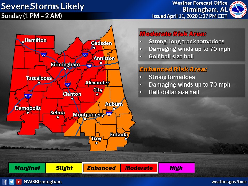
TIMING: 12AM-6AM ET ⏰
THREATS: Damaging winds, strong tornadoes, & large hail.
ACTION: Have a safety plan & multiple ways of reciving a warning!
️
TIMING: 12AM-6AM ET ⏰
THREATS: Damaging winds, strong tornadoes, & large hail.
ACTION: Have a safety plan & multiple ways of reciving a warning!  #alwx #gawx...
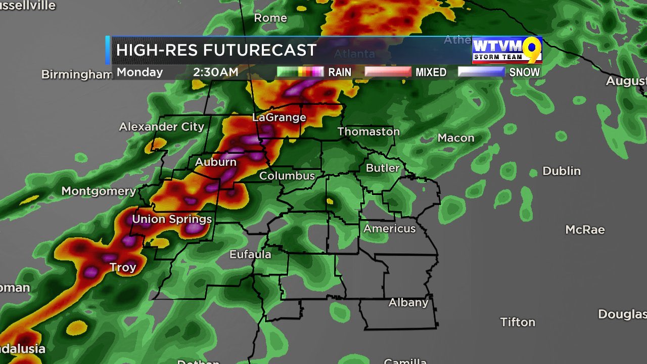
 of helicity swaths


 4
4
 4
4
 2
2


 4
4
 2
2


 ️ Text | maps | links | images: Join #public-event-channel or #4-12-20_arklatex_dixie to discuss this event
 Voice | video streaming: Join #weather-discussion. Use #wx-voice-text to drop text links and narrative
️ Zoom session for arm-chairing the event. Must be a zoom member to join https://zoom.us/s/812049617
To watch: https://www.youtube.com/watch?v=k0jm4b_AgVA
Voice | video streaming: Join #weather-discussion. Use #wx-voice-text to drop text links and narrative
️ Zoom session for arm-chairing the event. Must be a zoom member to join https://zoom.us/s/812049617
To watch: https://www.youtube.com/watch?v=k0jm4b_AgVA


 11
7
11
7
 6
6