Not sure how I'm feeling about IL on this latest run.
Jacob Melton (Owosso, MI)08-Jun-20 11:44 PM
Lower MI has some of my interest based on tonight's data.
Not a fan of it being a nighttime threat.
Cameron (Fortson, GA)09-Jun-20 12:37 AM
Seeing some funky hodos, look like updraft venting goes back into the hodo itself? It seems there's a lot of shear, but I don't know how much is "there" to anchor it, if you get my drift (edited)
Josh Zitko(Cimarron, NM/STL, MO)09-Jun-20 12:51 AM
I really don't know for central/south IL at this point
Cameron (Fortson, GA)09-Jun-20 12:54 AM
SFC low it is (edited)
Josh Zitko(Cimarron, NM/STL, MO)09-Jun-20 12:56 AM
Hm?
RAP showing similar hodos to the HRRR
Cameron (Fortson, GA)09-Jun-20 12:56 AM
Placement and timing seems to finnicky
Josh Zitko(Cimarron, NM/STL, MO)09-Jun-20 12:57 AM
Agreed. I'm not sure exactly what I'm looking at in terms of time, location for initiation (edited)
Cameron (Fortson, GA)09-Jun-20 12:57 AM
SFC low is placed differently on models as well, how much destablization you get, how much do dews advect
Josh Zitko(Cimarron, NM/STL, MO)09-Jun-20 01:05 AM
Might be a case of positioning myself and just watching GOES
Payton (Lawrence, KS)09-Jun-20 01:06 AM
I vote you go west
1
Josh Zitko(Cimarron, NM/STL, MO)09-Jun-20 01:10 AM
Josh Zitko(Cimarron, NM/STL, MO)09-Jun-20 01:55 AM
Ed Tierney (Des Plaines, IL)09-Jun-20 09:11 AM
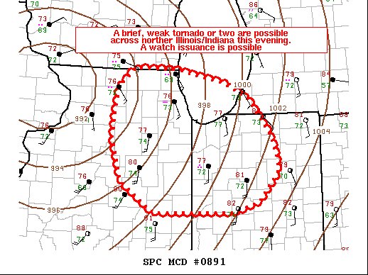
10% may come to IL/IN in later outlooks
PORTIONS OF ILLINOIS (ROUGHLY THE EASTERN HALF) INTO INDIANA
WILL BE REEVALUATED IN SUBSEQUENT OUTLOOKS FOR A POSSIBLE
TORNADO-RELATED RISK UPGRADE (10% ENHANCED)
A mid-level dry slot on the southern fringe of the Cristobal should
continue to develop east-northeastward over southeast Missouri and
western portions of Kentucky/Tennessee toward Illinois/Indiana
through the afternoon. With a very moist air mass (low 70s F surface
dewpoints) also developing northward, dry slot-related cloud breaks
and diurnal heating will contribute to weakening inhibition and
moderate buoyancy by afternoon, particularly across Illinois into
western/central Indiana. The north/northeastward-expanding core of
strongest low/mid-level winds will also reside within this same
corridor, including an increasing mid-level westerly component this
afternoon, which could boost the potential for somewhat longer
duration/semi-discrete updraft rotation. A few tornadoes may occur
across the region, along with isolated thunderstorm-related wind
damage. Portions of Illinois (roughly the eastern half) into Indiana
will be reevaluated in subsequent outlooks for a possible
tornado-related risk upgrade (10% Enhanced).
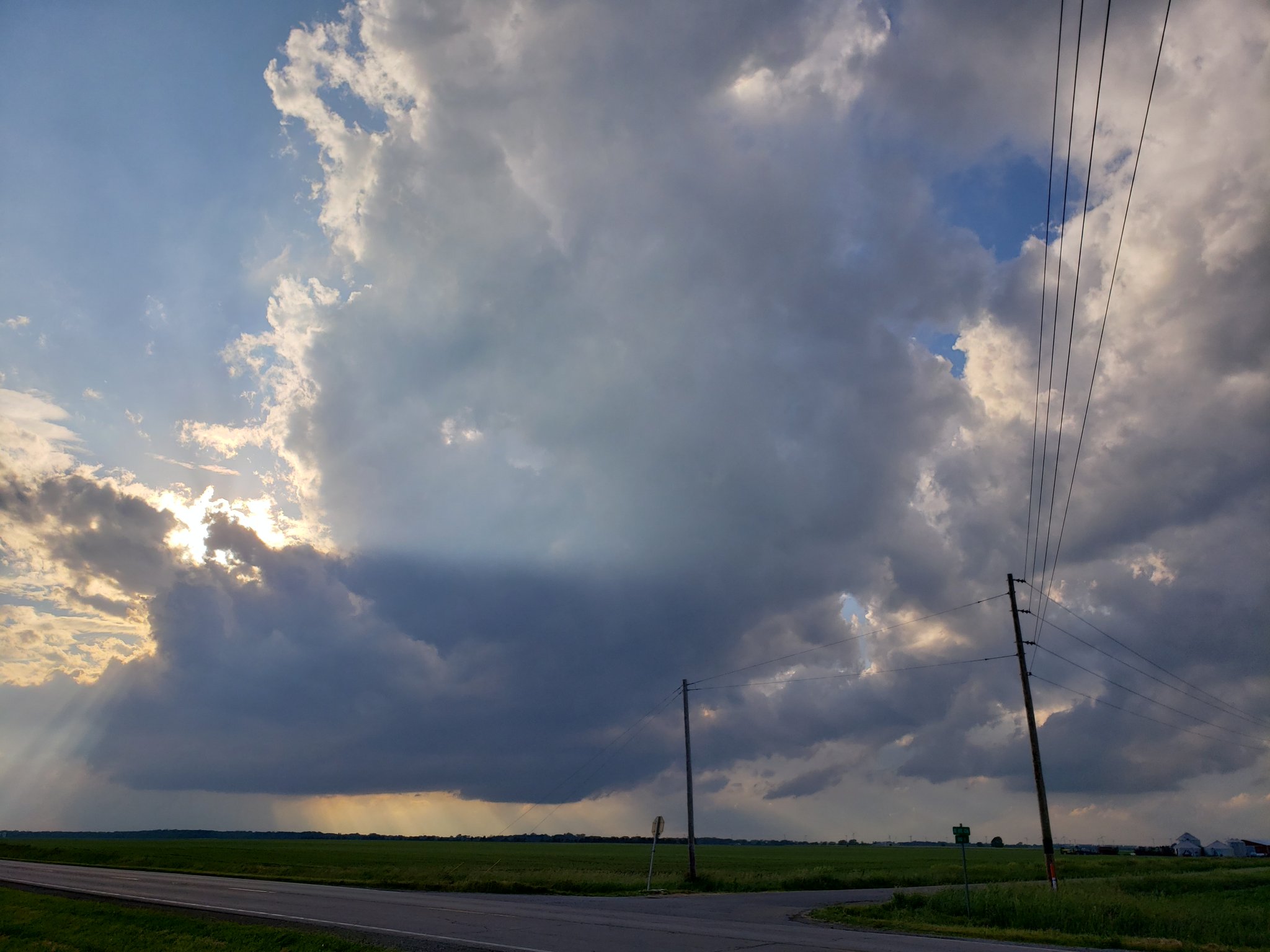
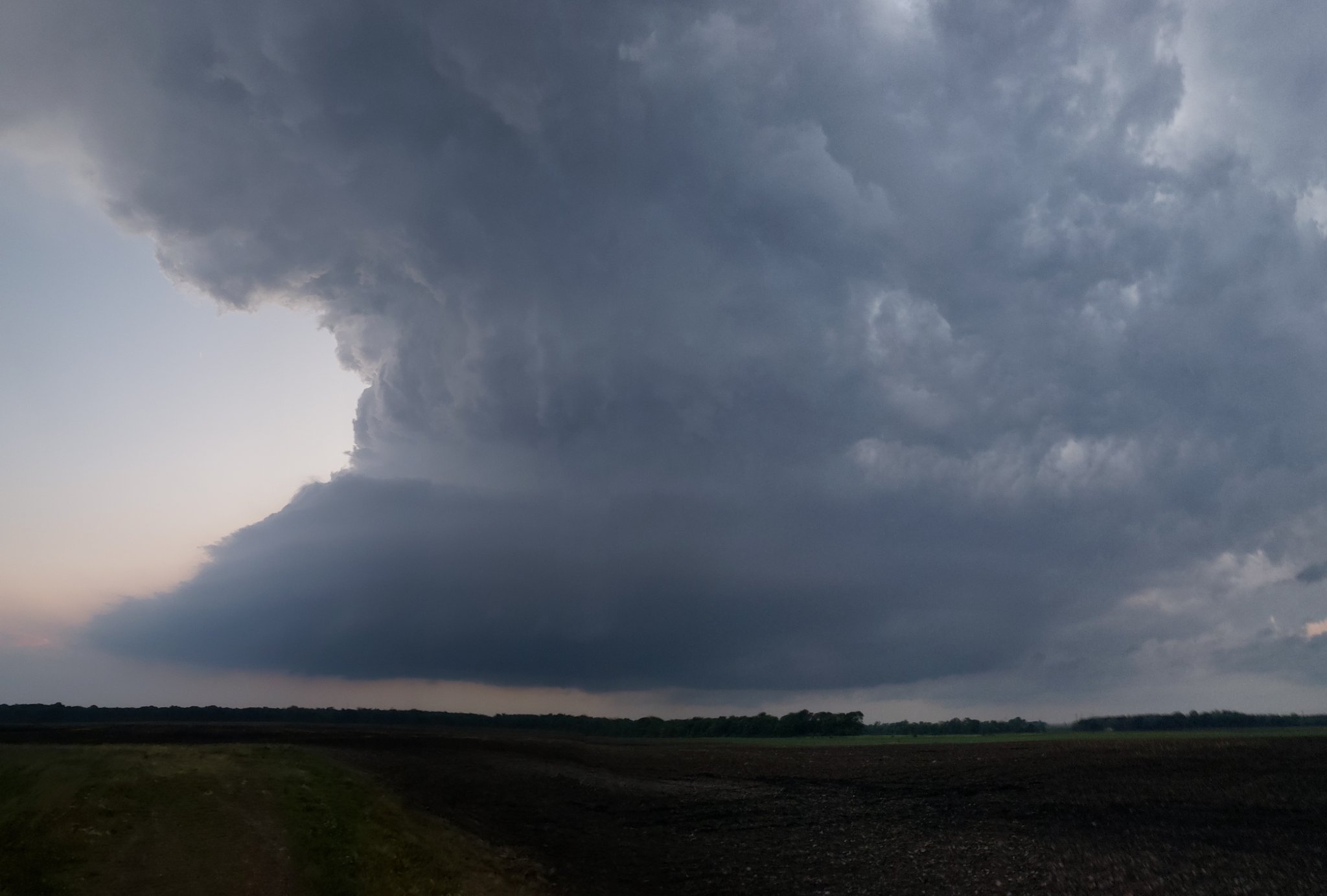
Severe thunderstorms, associated with the remnants of Tropical Storm Cristobal have moved into the Chicago area. O’Hare Airport reported a wind gust to 60 mph at 3:25 pm and Midway Airport lo…


 1
1