Guild icon
Stormtrack
EVENT ARCHIVE / 09-03-2020_de-md-nj-pa-va-wv
Avatar
Jeff House (Chattanooga, TN) 03-Sep-20 11:55 AM
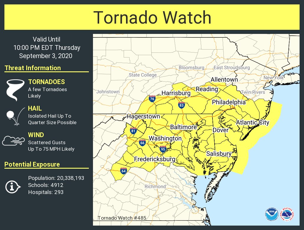
Wish I'm in Baltimore today. West and North of suburbia can be chased. Boundary will produce. Rare the Mid Atlantic isn't contaminated. 700 mb Ts just right. LLJ will go when Kentucky wave (water vapor) arrives. Despite DC verring, SRH will be there on the boundary up near BWI. Left front of jet max early. But right rear lift right on time with Kentucky wave. It's going to produce. And the dewpoint induced CAPE will help bullish CAMs verify. (edited)
Avatar
B. Dean Berry (Pittsburgh PA) ✱ 03-Sep-20 12:07 PM
Definitely a strong signal for the region. Let's hope NORVA and Bmore is on their game today.
Avatar
Jacob Melton (Owosso, MI) 03-Sep-20 03:40 PM
A tornado watch has been issued for parts of DE, DC, MD, NJ, PA, VA, WV until 10 PM EDT
Avatar
Jacob Melton (Owosso, MI) 03-Sep-20 07:12 PM
Trained NWS spotter confirms damage coincident with radar tornadic signature at ~5:58pm in Anne Arundel County, just south of Annapolis in Edgewater MD. Multiple trees/power poles downed. Siding/shingle damage to homes. Along Route 2 just S of the South River bridge. #mdwx
Avatar
Jeff House (Chattanooga, TN) 03-Sep-20 08:32 PM
Cooking boundaries produce just like in our beloved Great Plains.
Exported 5 message(s)