Stormtrack
EVENT ARCHIVE / cristobal-discussion-2020


 9
9


 5
5


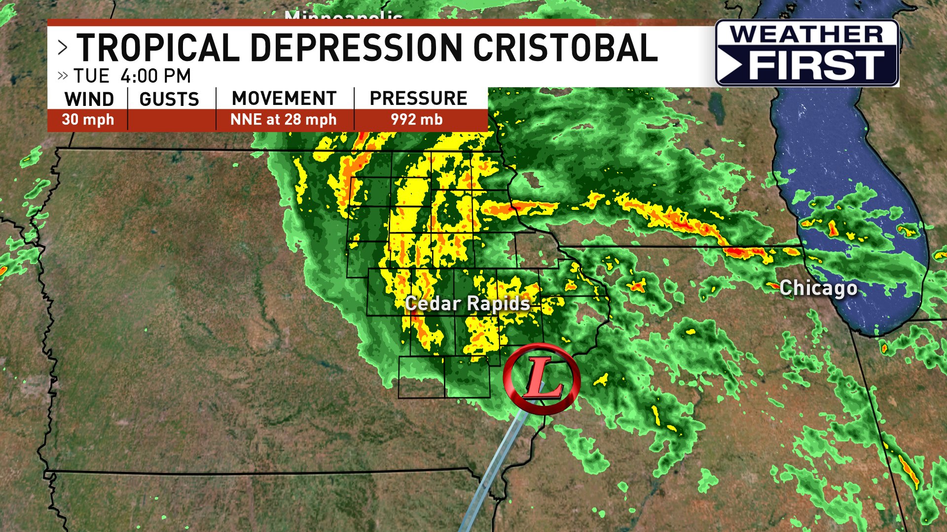
 Legit tropical storm-like conditions in Great Lakes.
  ECMWF 12z parallel:
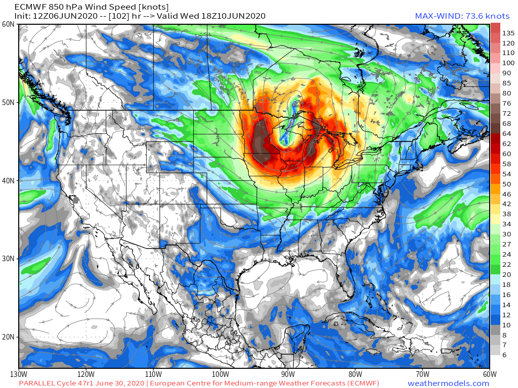


 3
3


 (edited)


 2
2
 1
1
 1
1


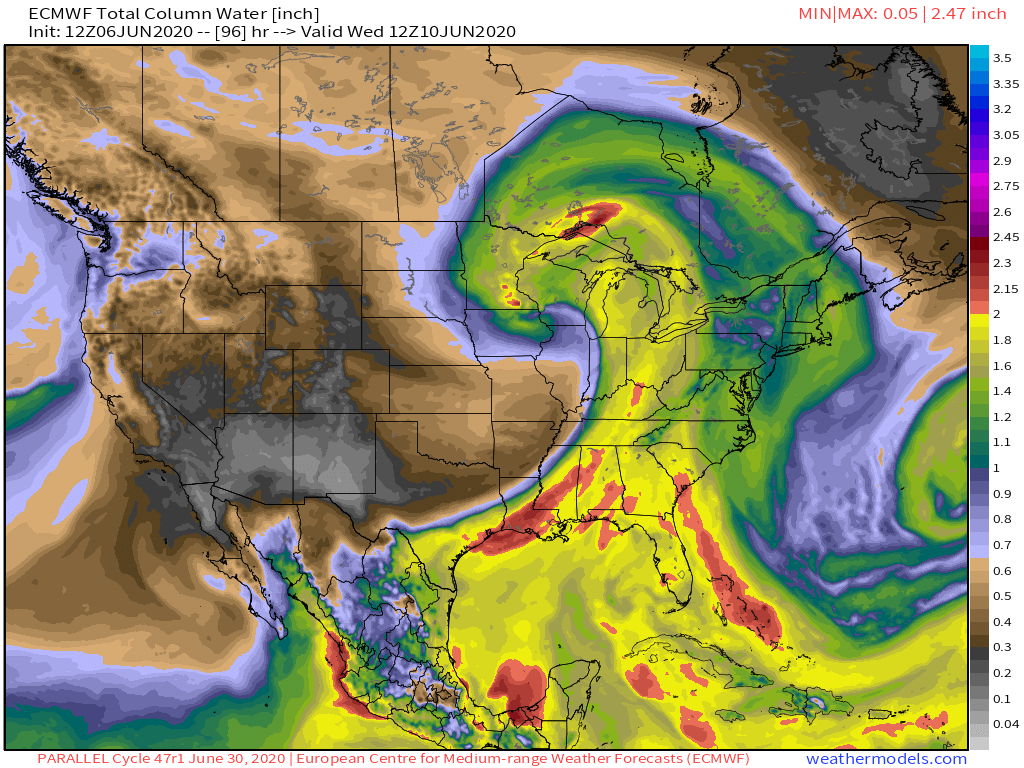
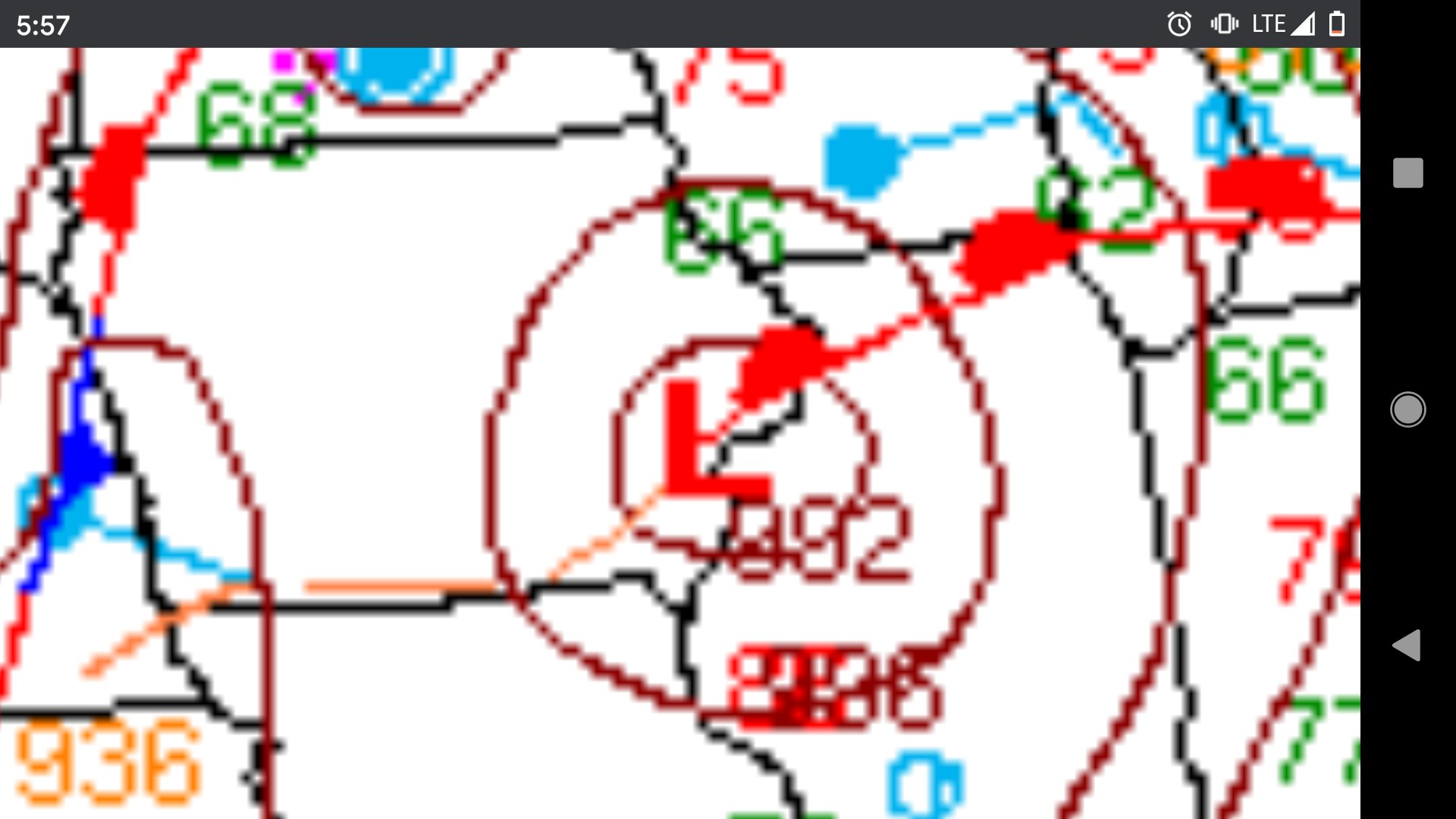
 The low is modeled to track right over my part of MN (edited)


 6
6