Stormtrack
EVENT ARCHIVE / hurricane-hanna-2020
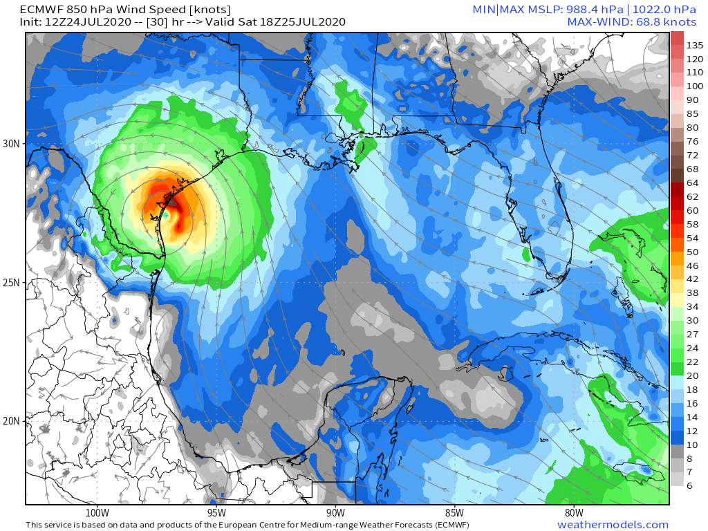
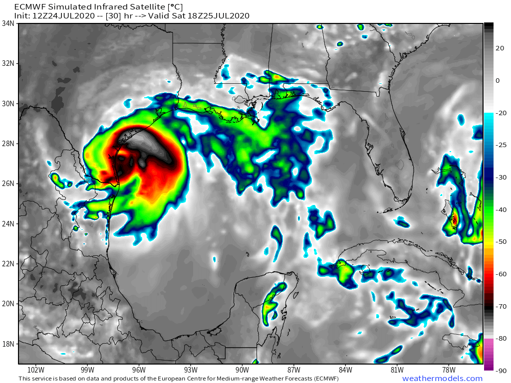
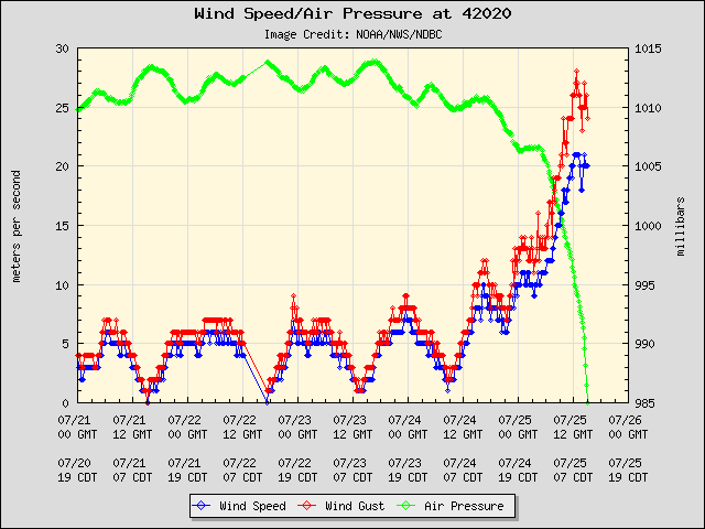
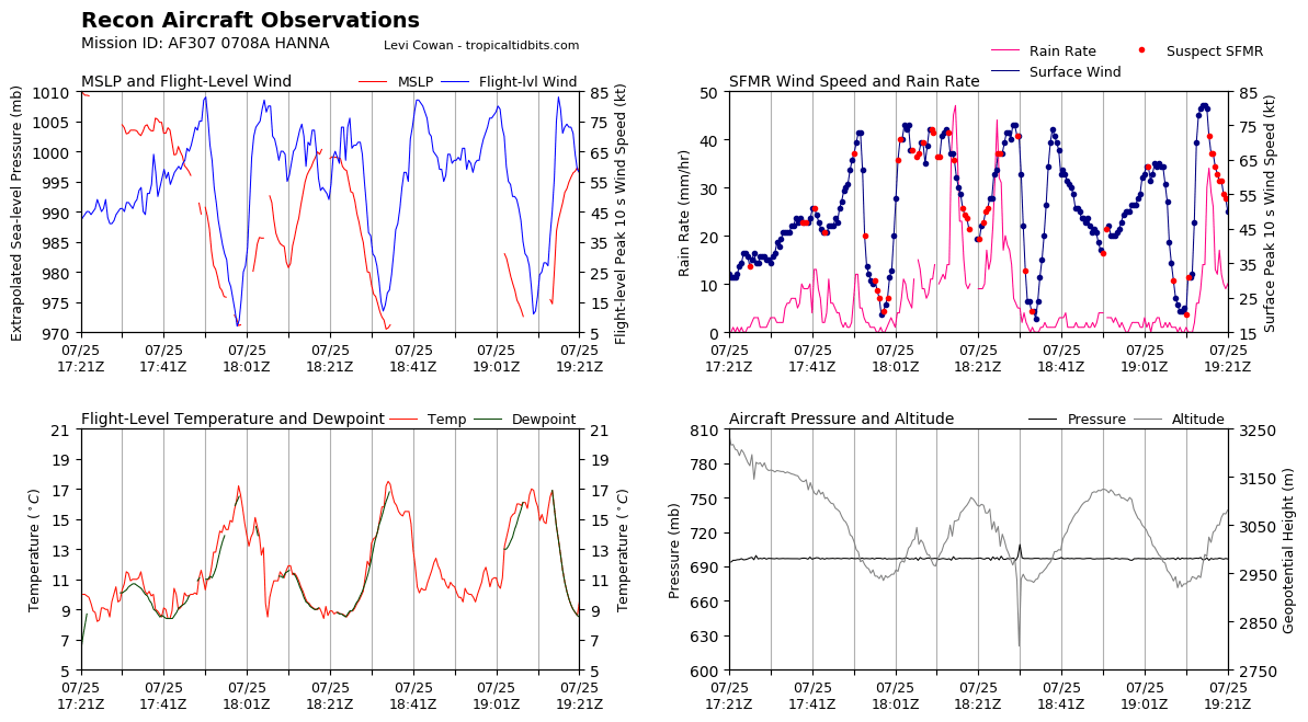
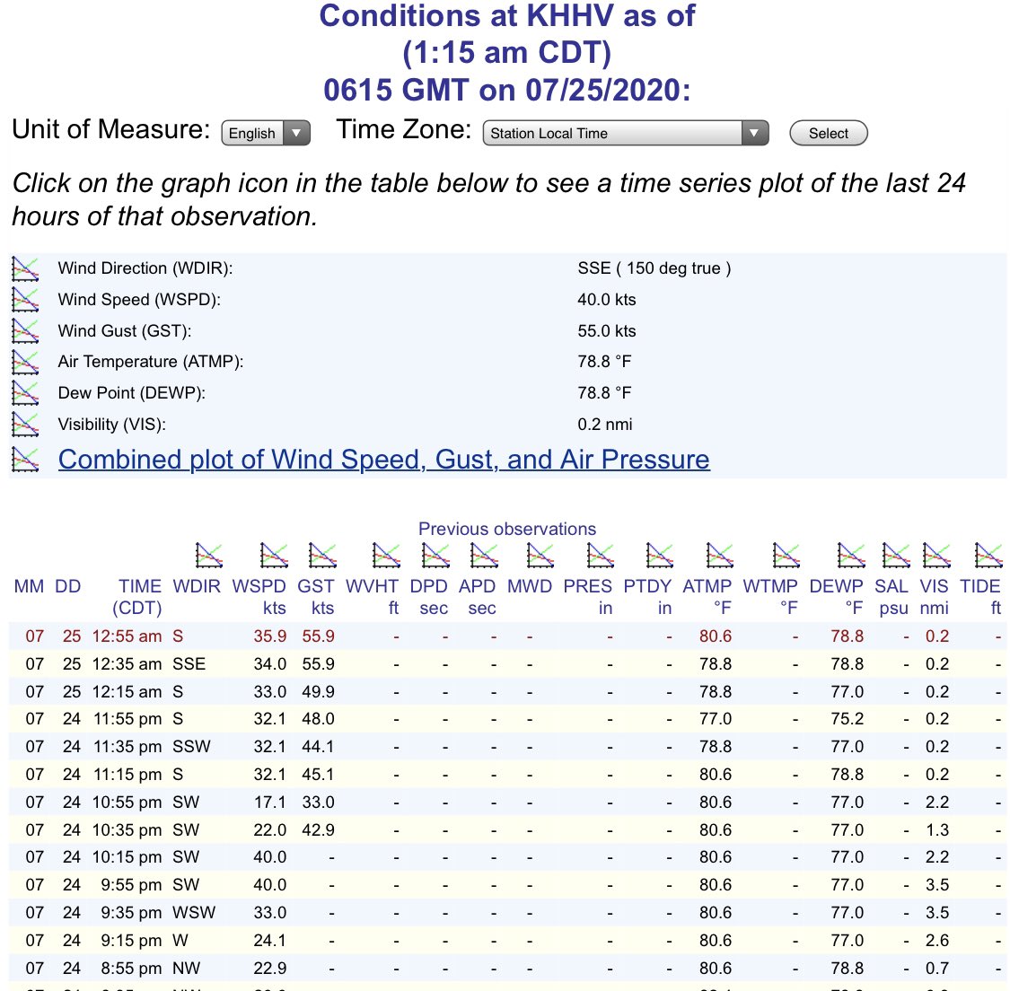
<:category1:616342499702865951> 7:00 PM CDT Sat Jul 25 | Location: 26.7°N 97.5°W | Moving: WSW at 8 mph | Min pressure: 975 mb | Max sustained: 85 mph


 2
2
 2
2


 2
2

 5
5


 3
3

 6
6


 3
3
 4
4
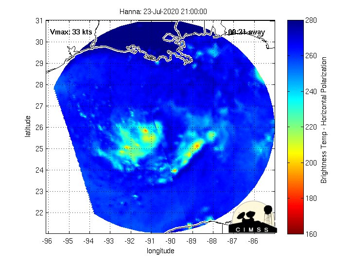
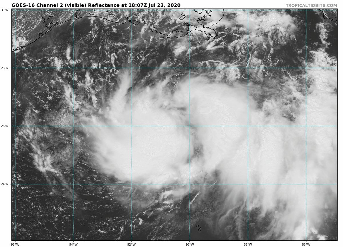
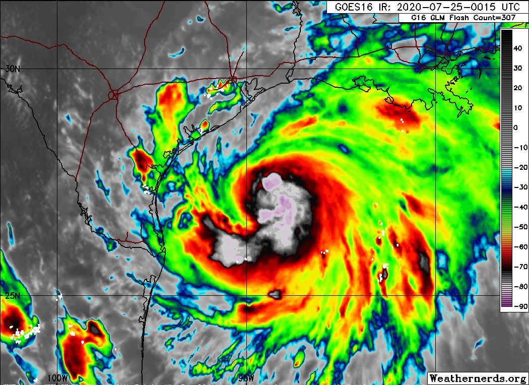
 Storm #Hanna. An inner core of strong convection wrapped around the center of circulation has developed.
#HurricaneSeason2020
Storm #Hanna. An inner core of strong convection wrapped around the center of circulation has developed.
#HurricaneSeason2020


 5
6
5
6
 4
5
4
5


 4
4

 7
7


 4
4


 4
4


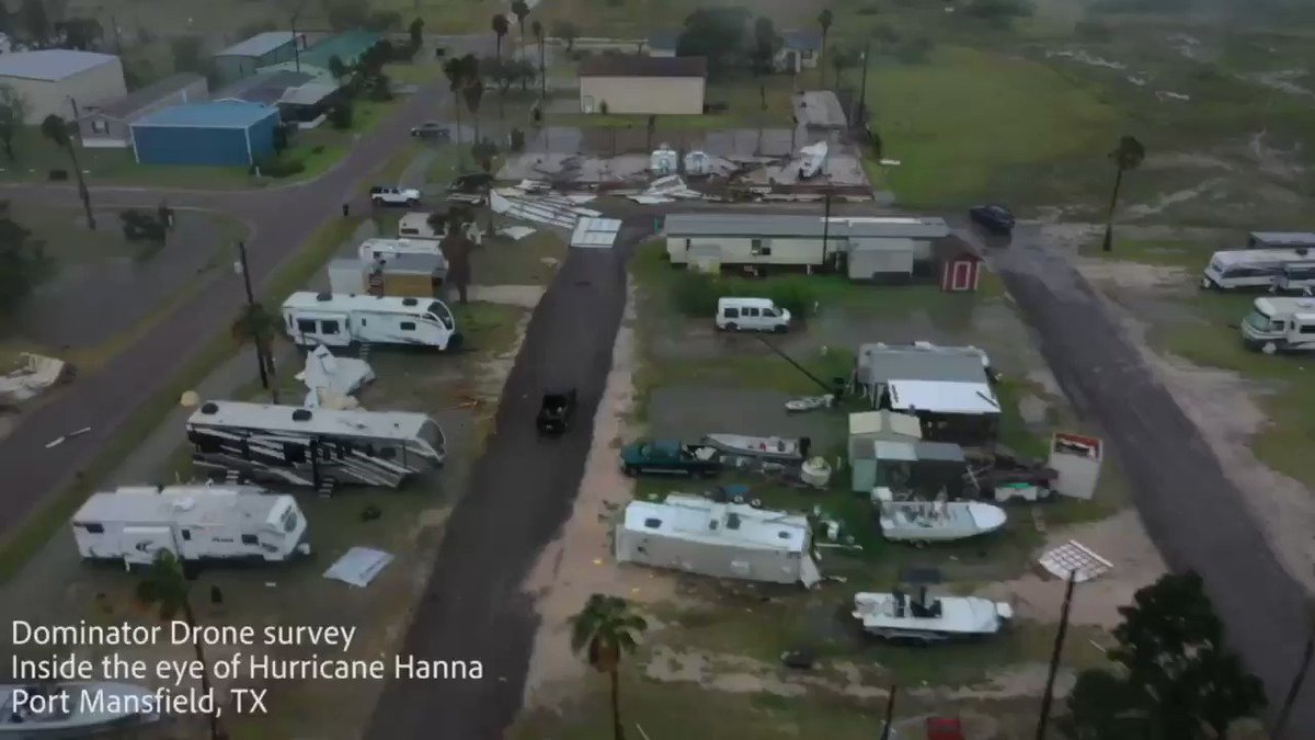
 One of my Patreon supporters from FL reminded me of this....
 3
3


 wants to go back to taped programming at 8pm ct


 7
7


 2
2


 5
5

 2
2


 7
7


 3
3


 2
2


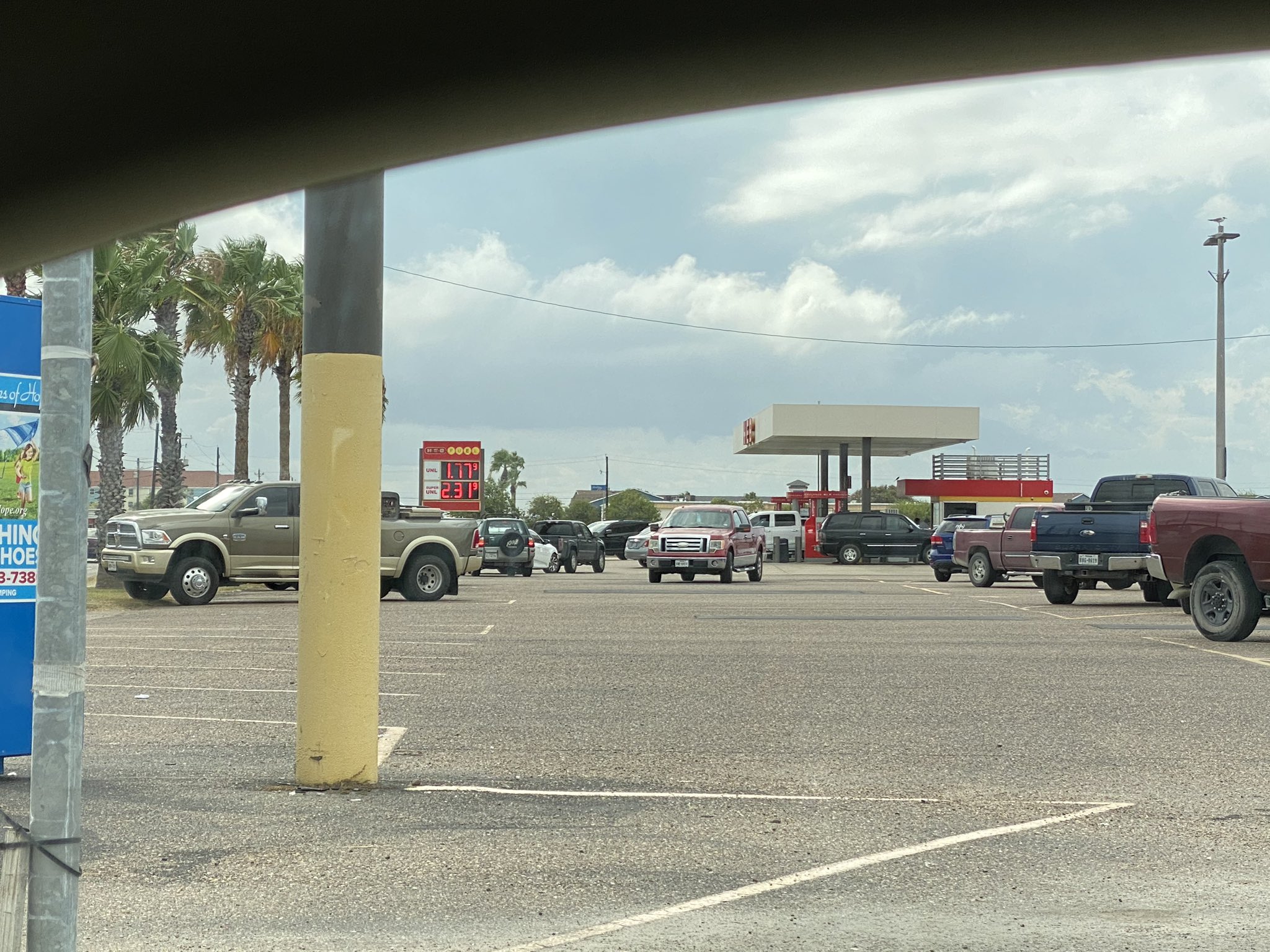
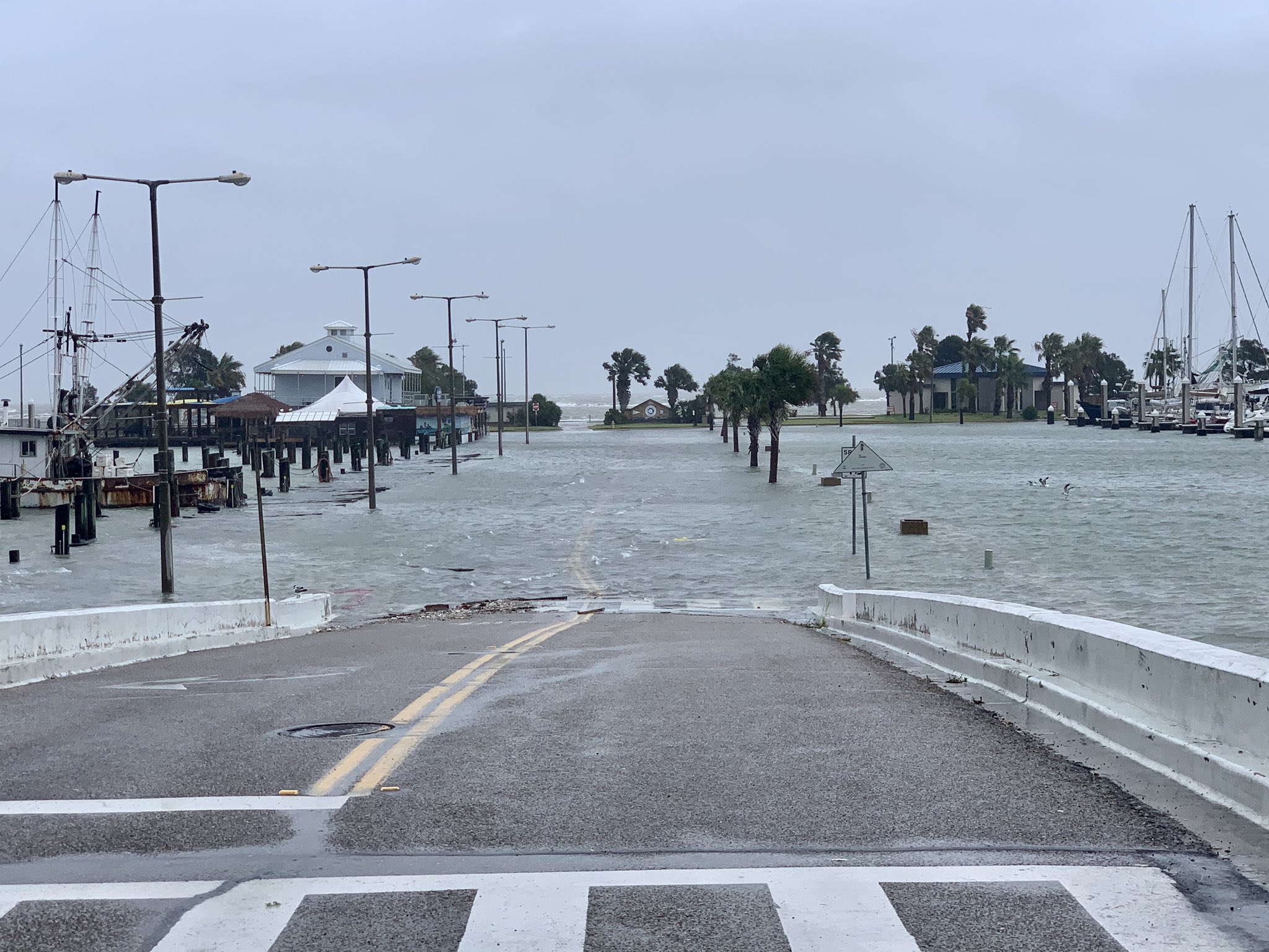
 Joey Garza, Pier 99 Restaurant @StormHour @HankAllenWX
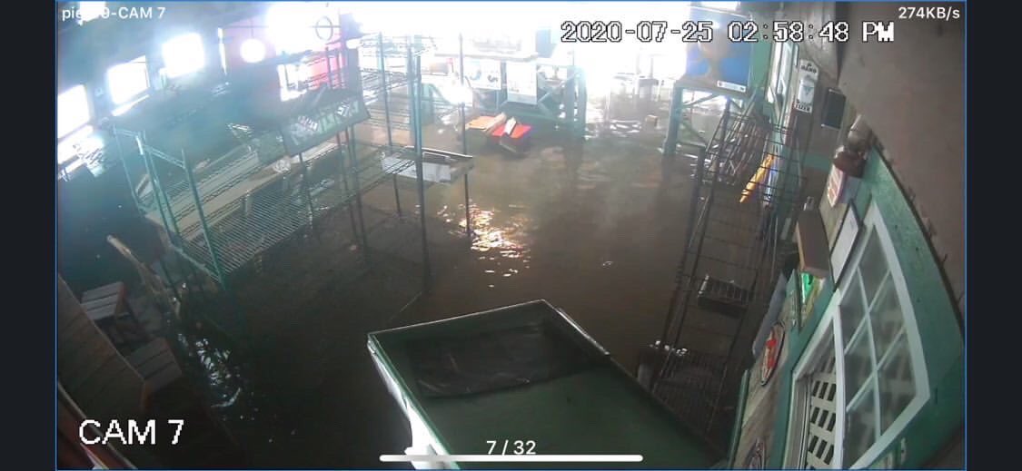
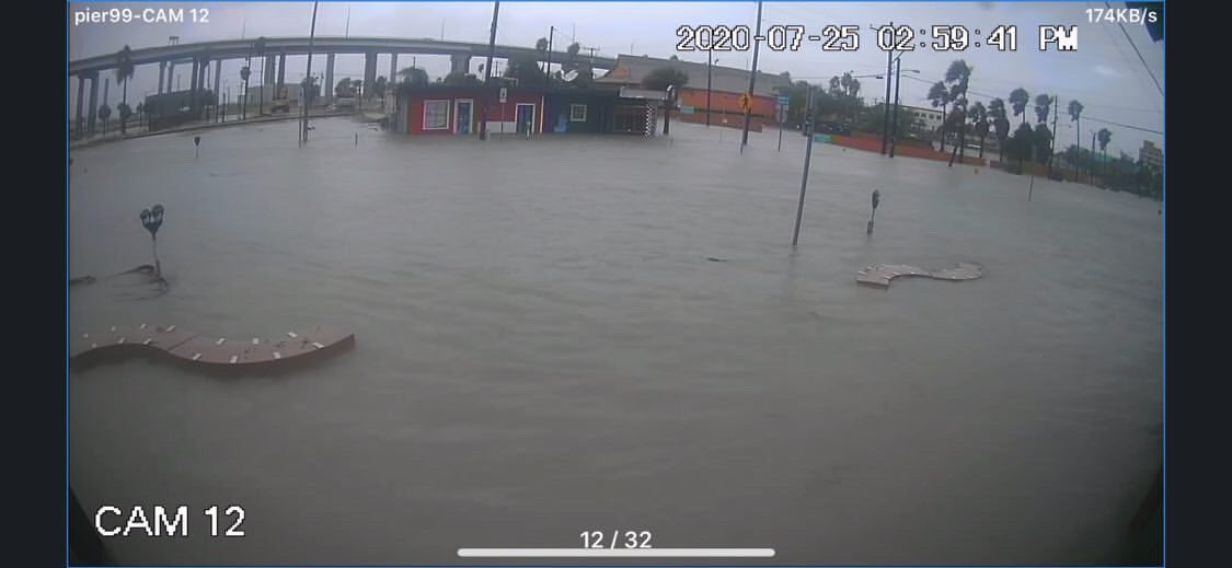
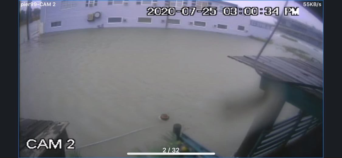
 Joey Garza, Pier 99 Restaurant @StormHour @HankAllenWX


 7
4
7
4


 5
5


 4
3
4
3


