Stormtrack
EVENT ARCHIVE / hurricane-isaias-2020
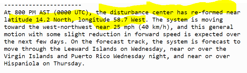
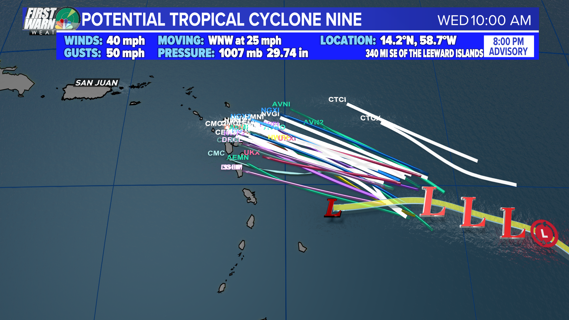
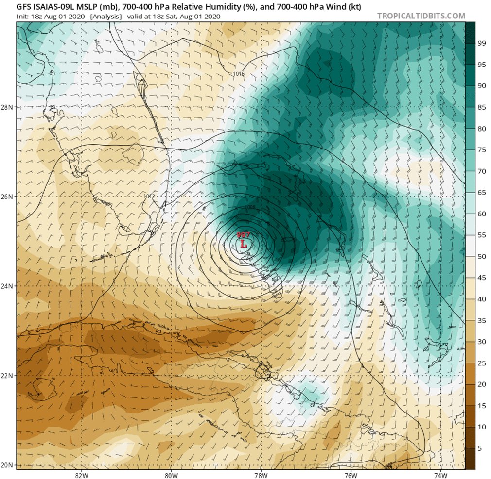
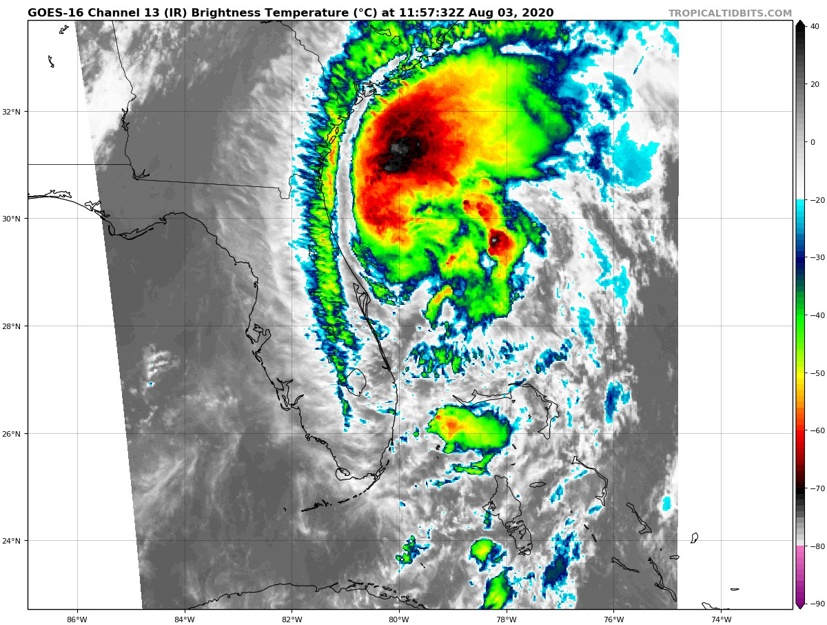
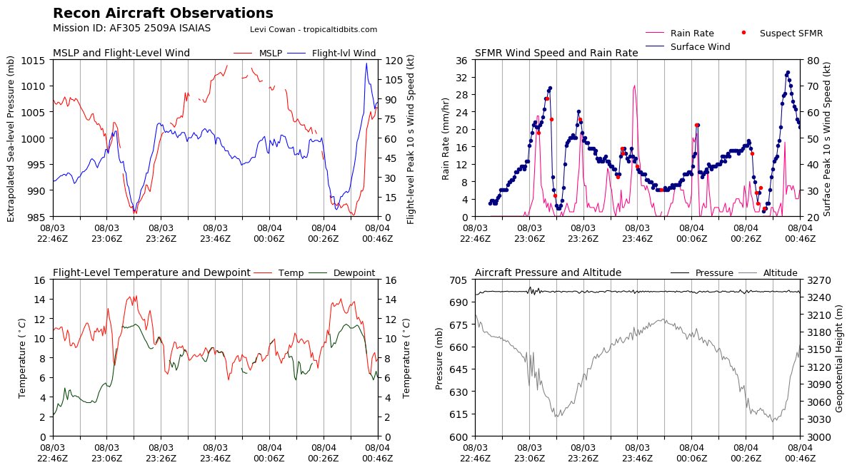
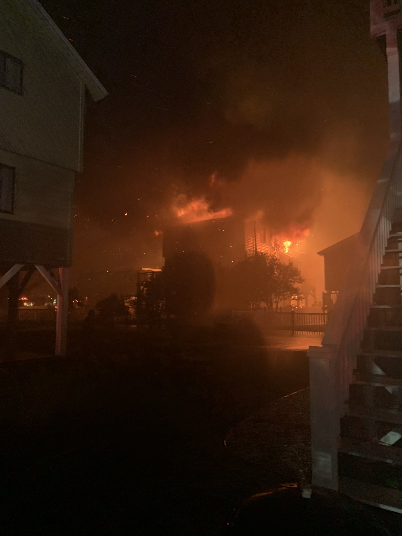
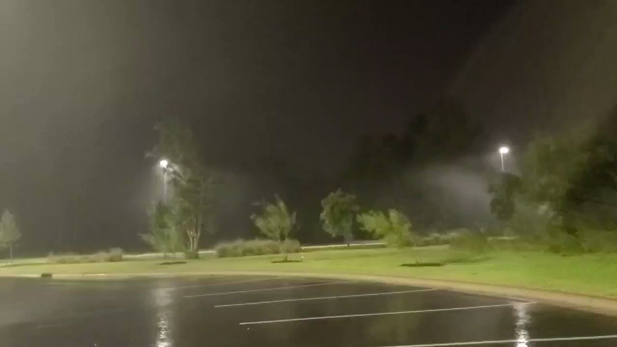
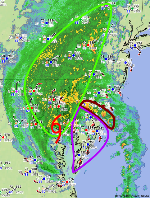
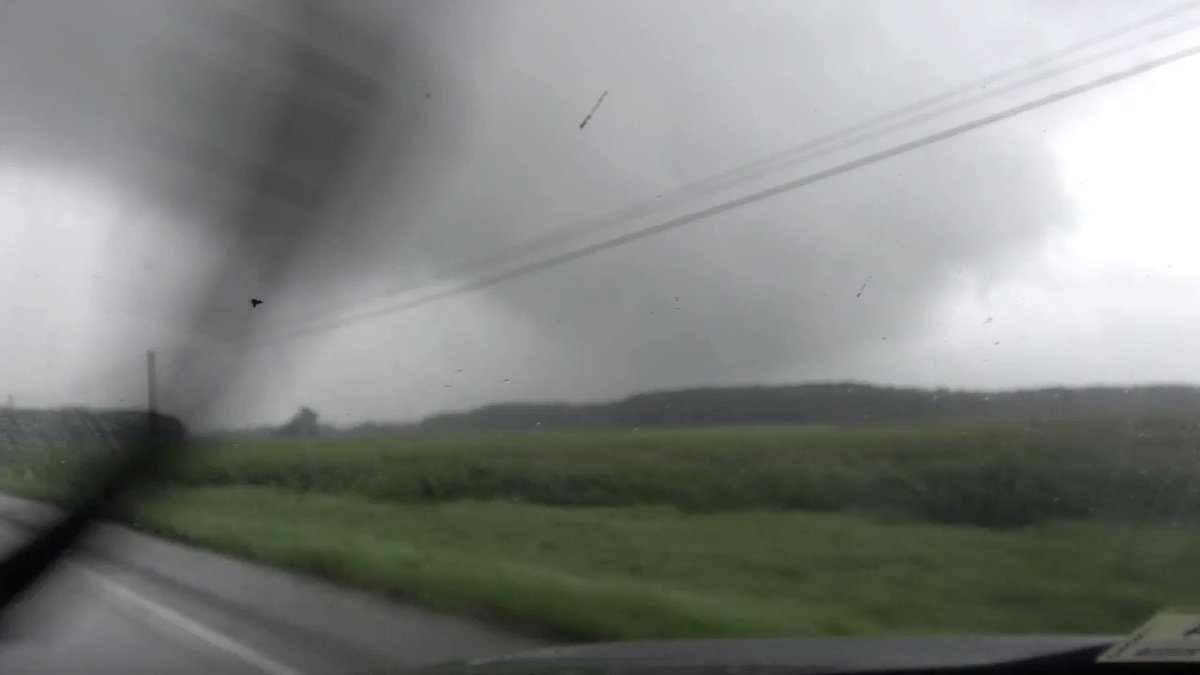
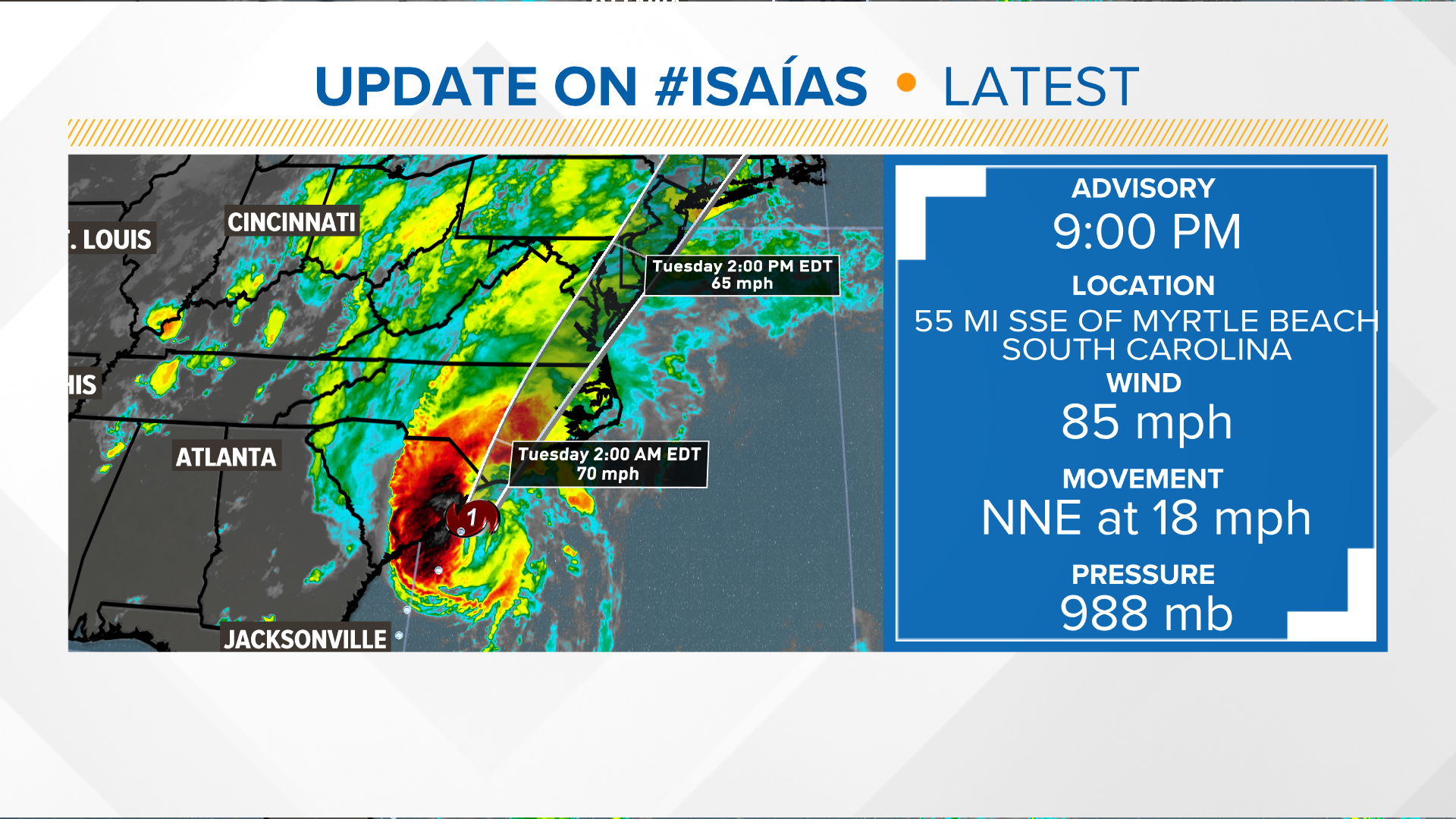
<:category1:616342499702865951> 8:00 PM EDT Mon Aug 3 | Location: 32.8°N 79.0°W | Moving: NNE at 16 mph | Min pressure: 988 mb | Max sustained: 75 mph


 2
2
 2
2


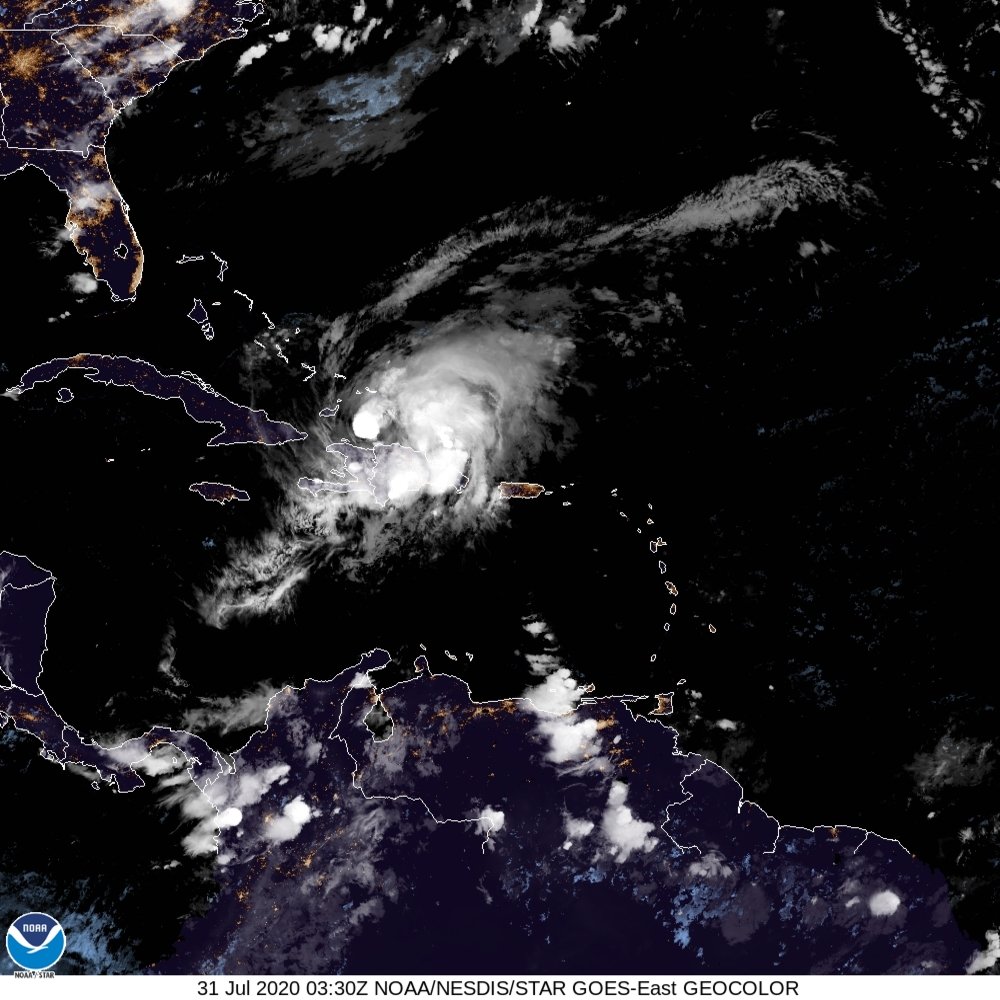
 7
7
 2
2
 1
1


 2
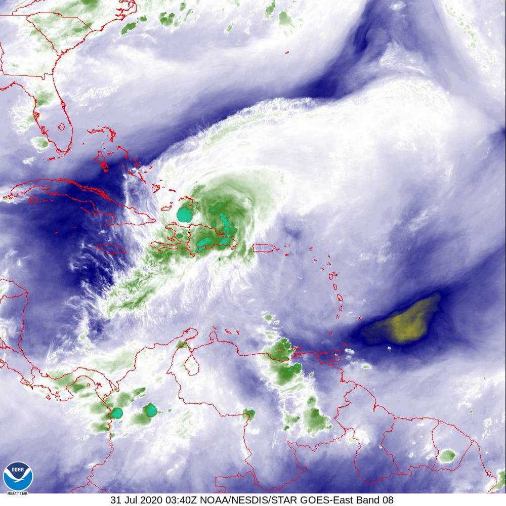
7
2
7


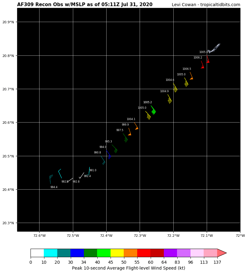
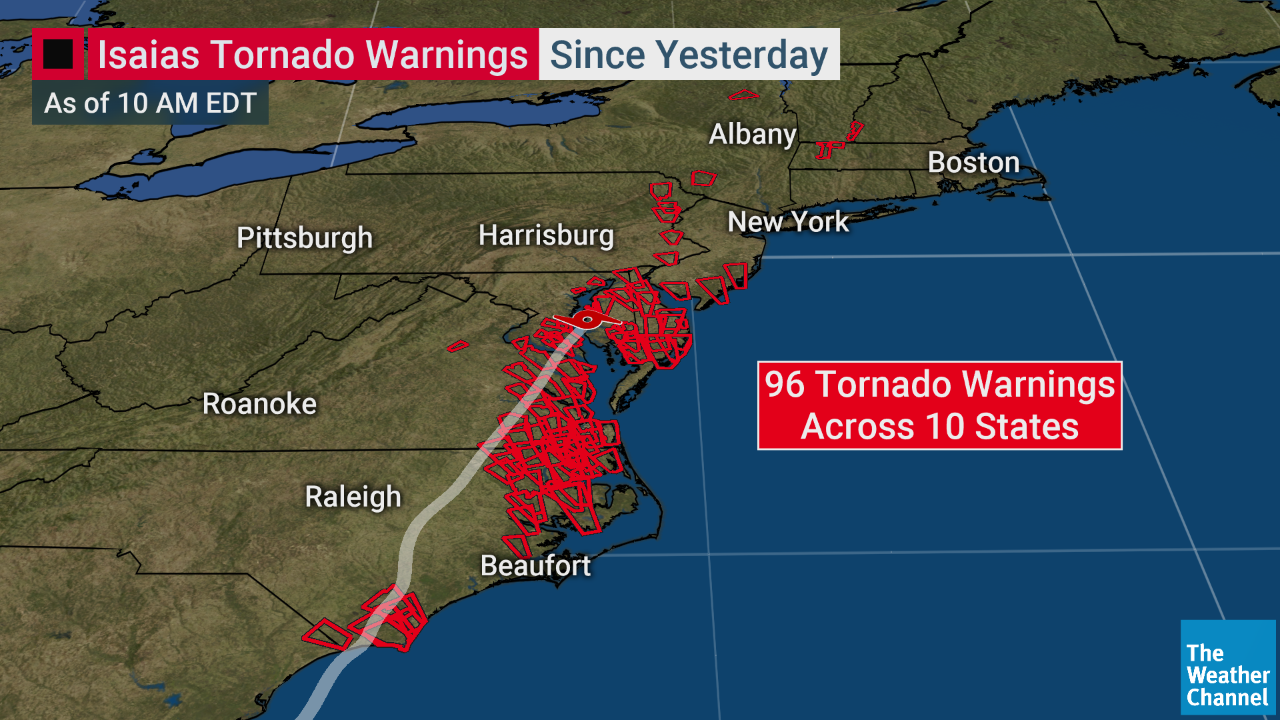
 6
6


 2
6
2
6


 2
2
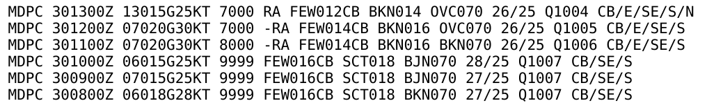
 4
4
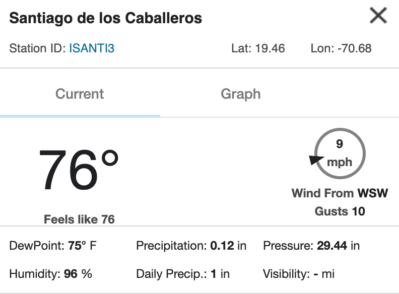
 5
5


 4
4

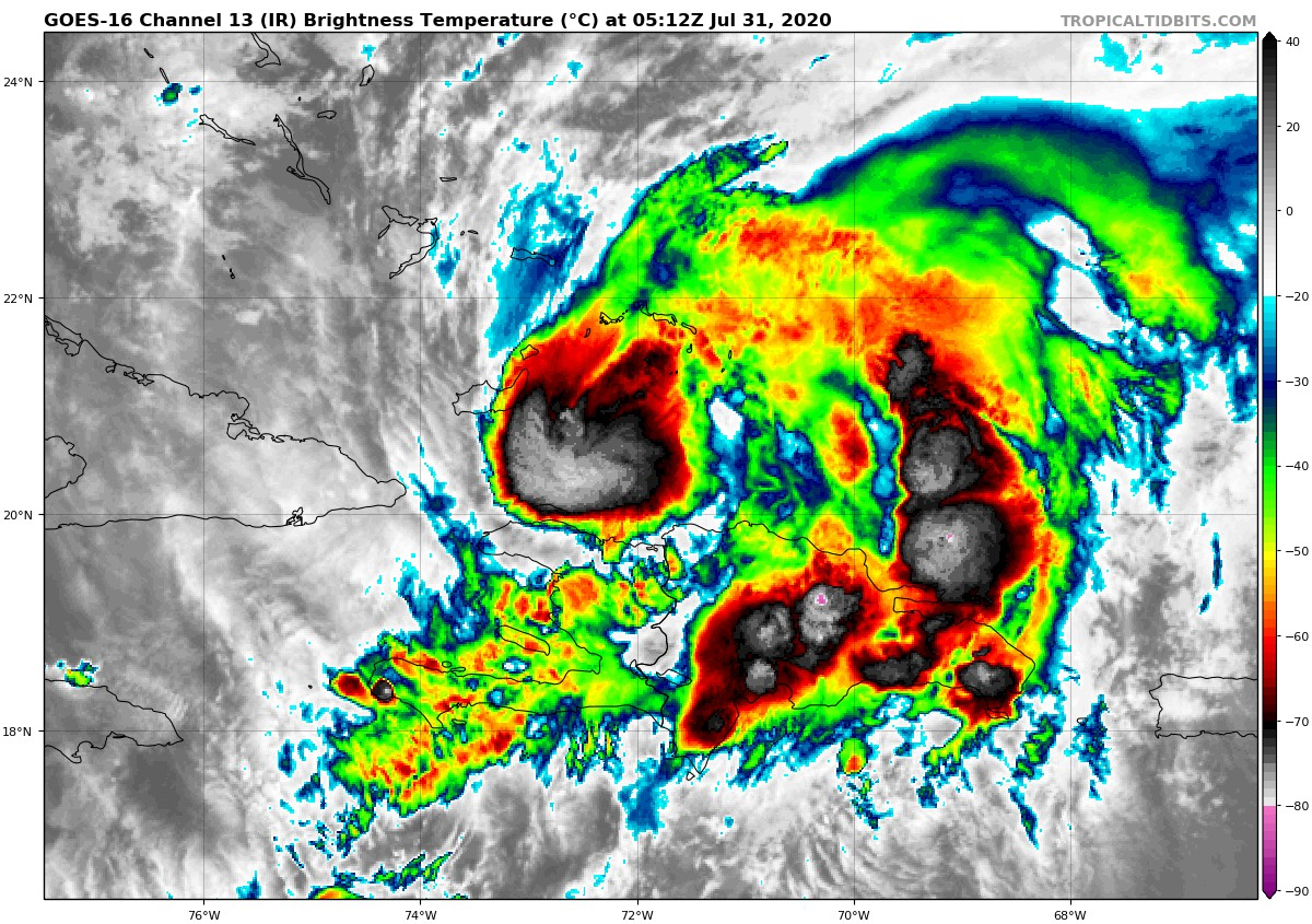
 6
6
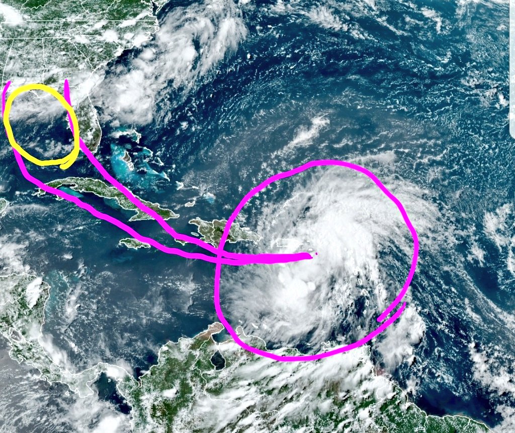
 3
3


 2
https://www.mlive.com/weather/2020/07/hurricane-isaias-will-bring-rain-to-michigan-but-in-a-way-you-may-not-expect.html
2
https://www.mlive.com/weather/2020/07/hurricane-isaias-will-bring-rain-to-michigan-but-in-a-way-you-may-not-expect.html 


 4
4

 2
2
 2
2


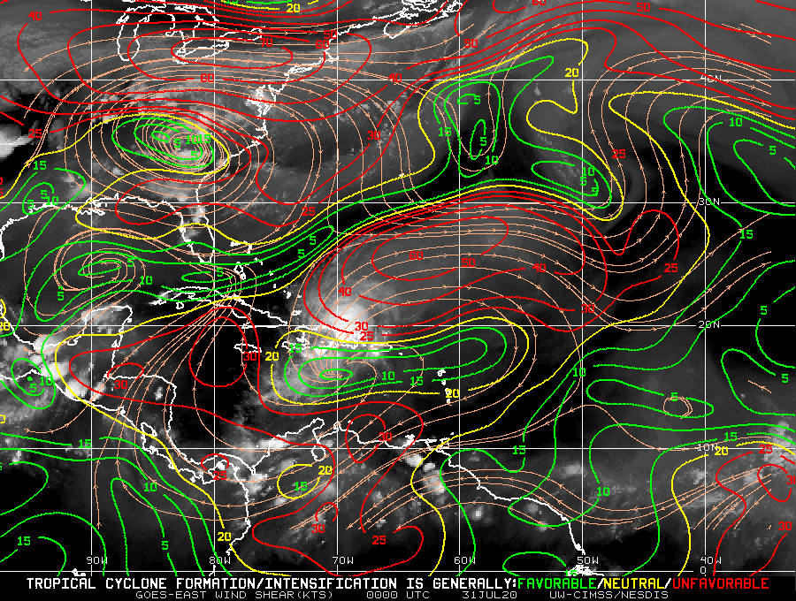
 6
6


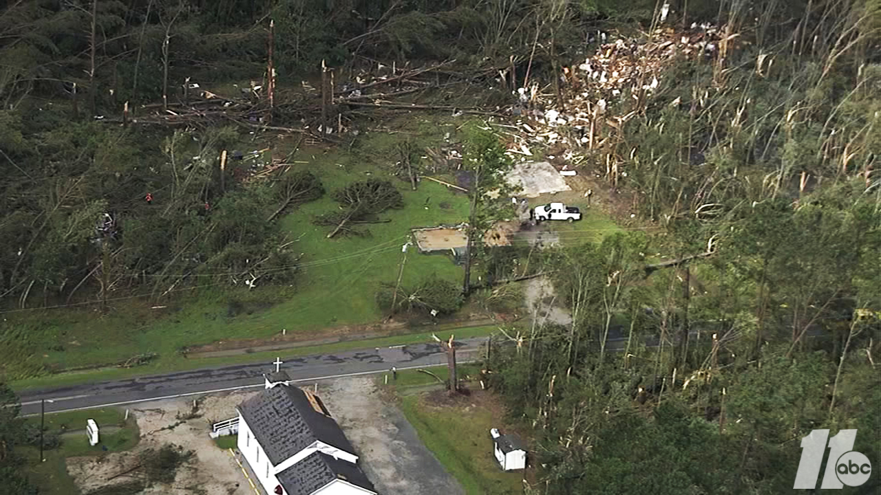
 8
8


 8
8


 2
2


 1
3
1
1
1
1
3
1
1
1
 3
3


 4
4
 2
2
 5
3
5
3


 3
3


 3
3

 3
3
 3
3
 4
5
4
5
 2
2
 2
2


 6
6
 2
2


 5
5

 4
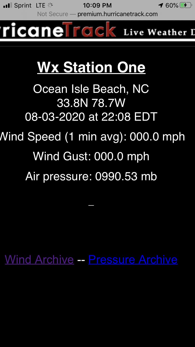
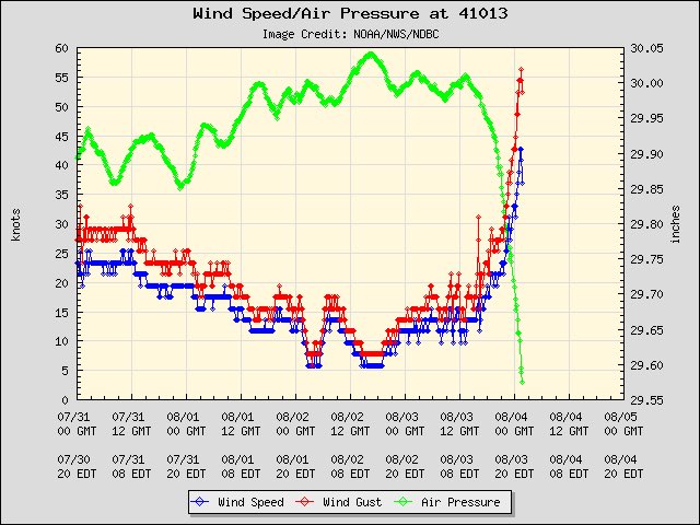
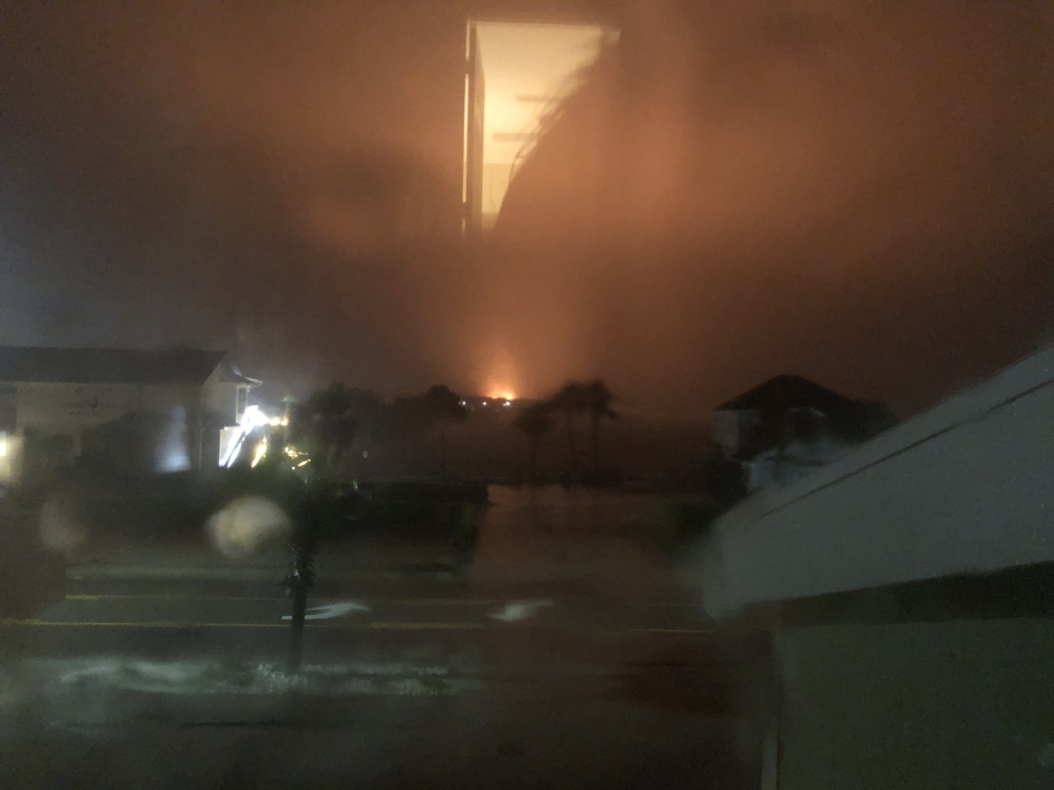
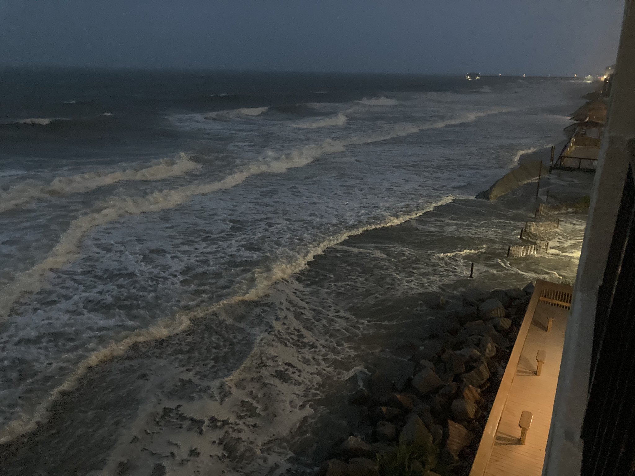
Guessing this is an error or the Wrightsville buoy got hit by a waterspout. #Isaias #ncwx
4
Guessing this is an error or the Wrightsville buoy got hit by a waterspout. #Isaias #ncwx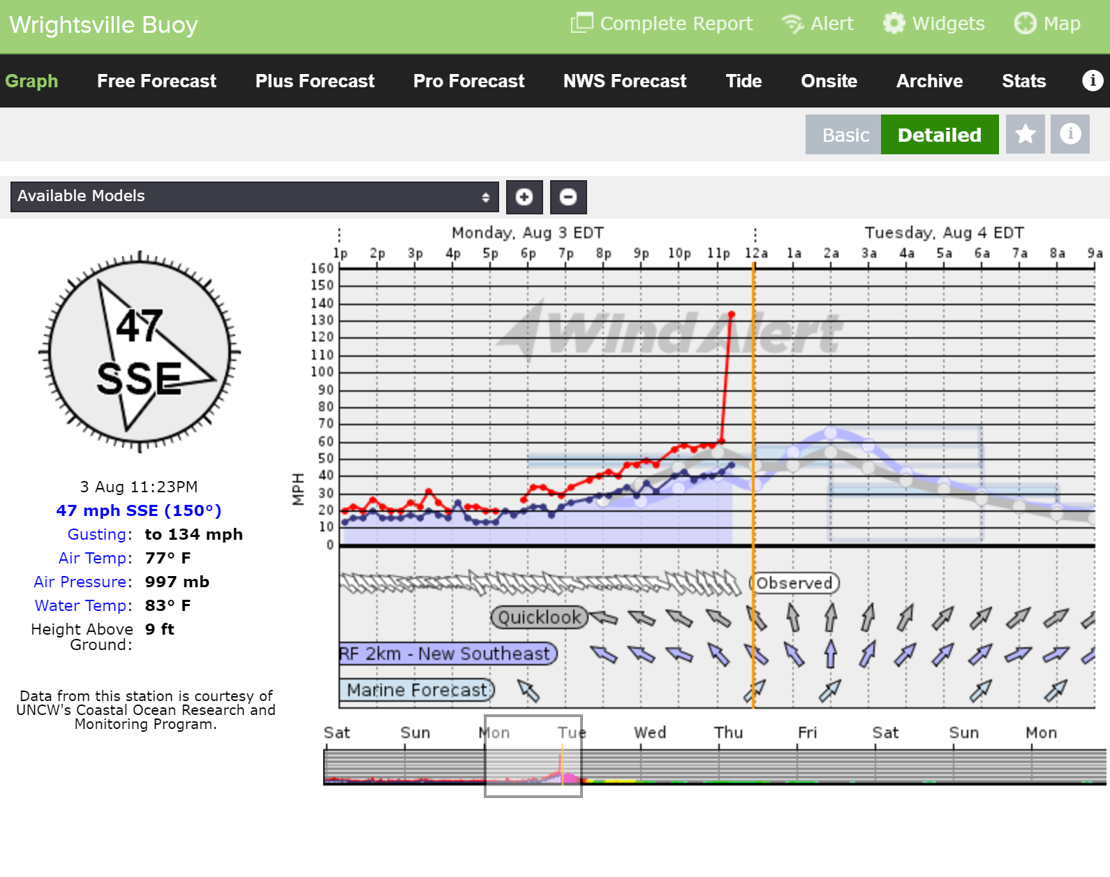


 2
2
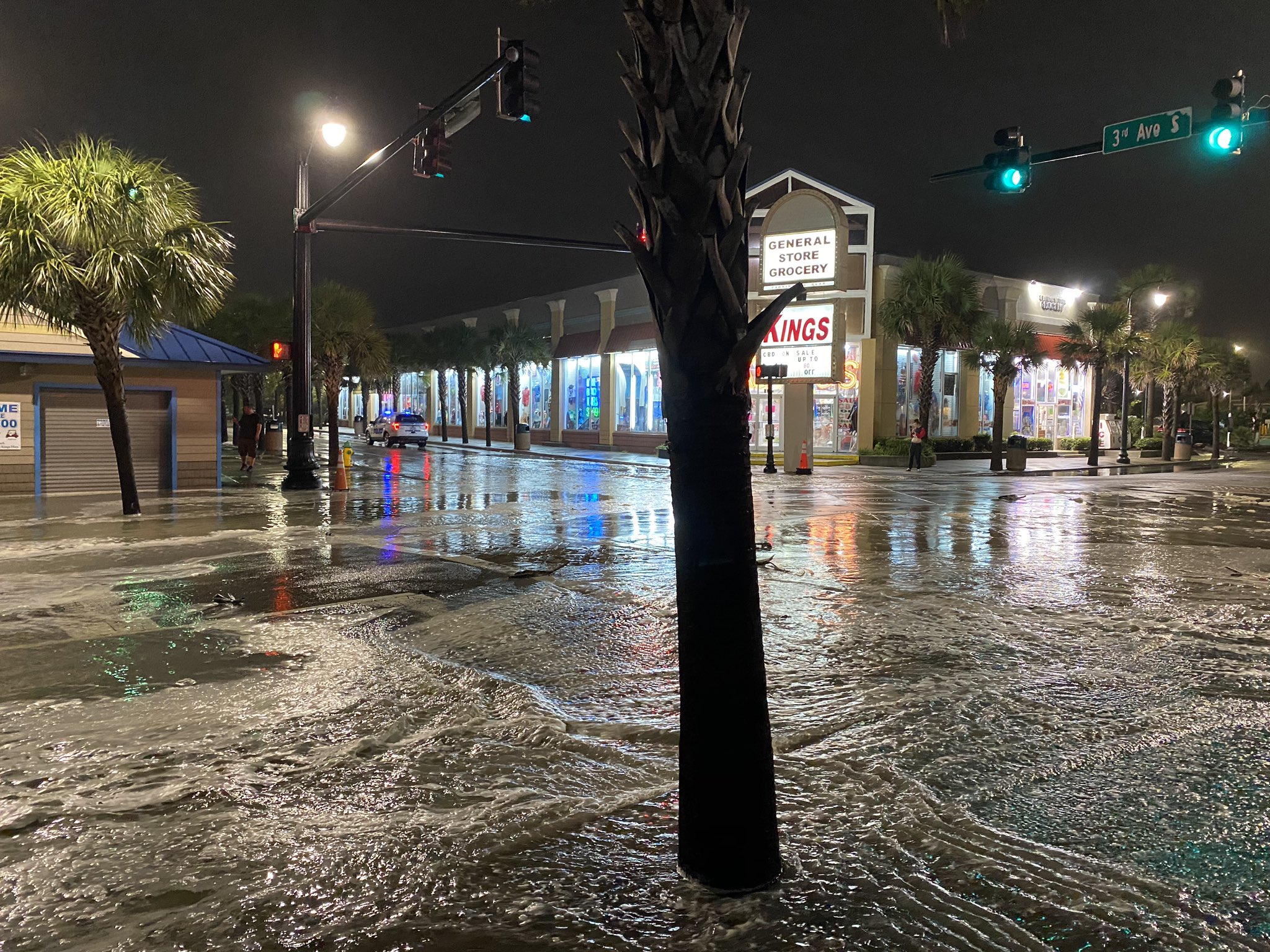
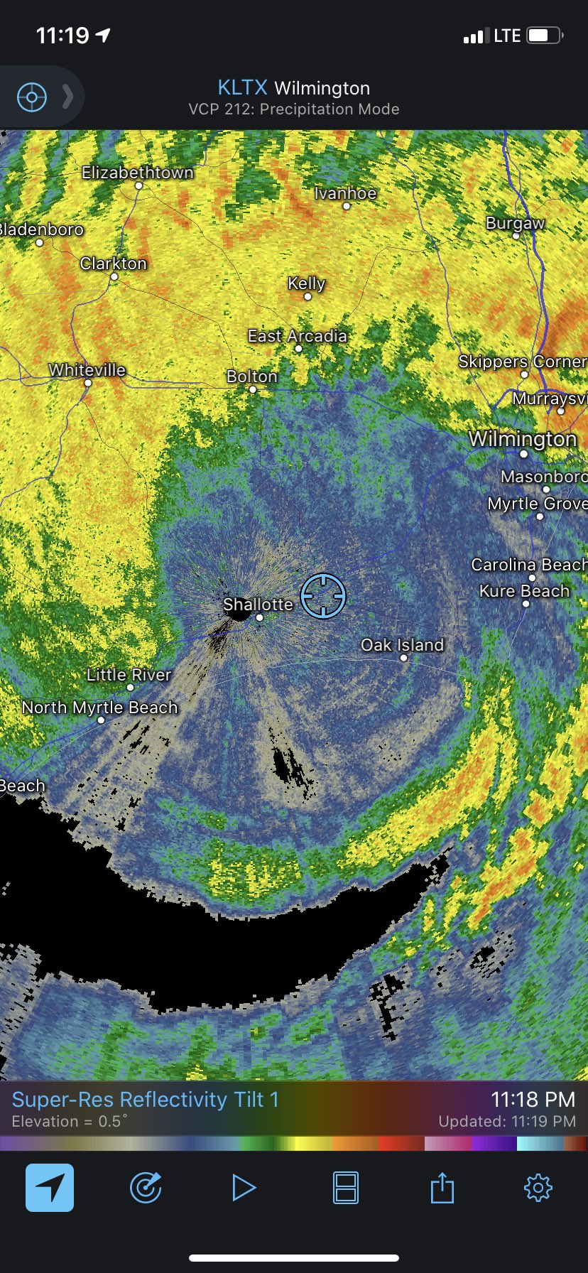
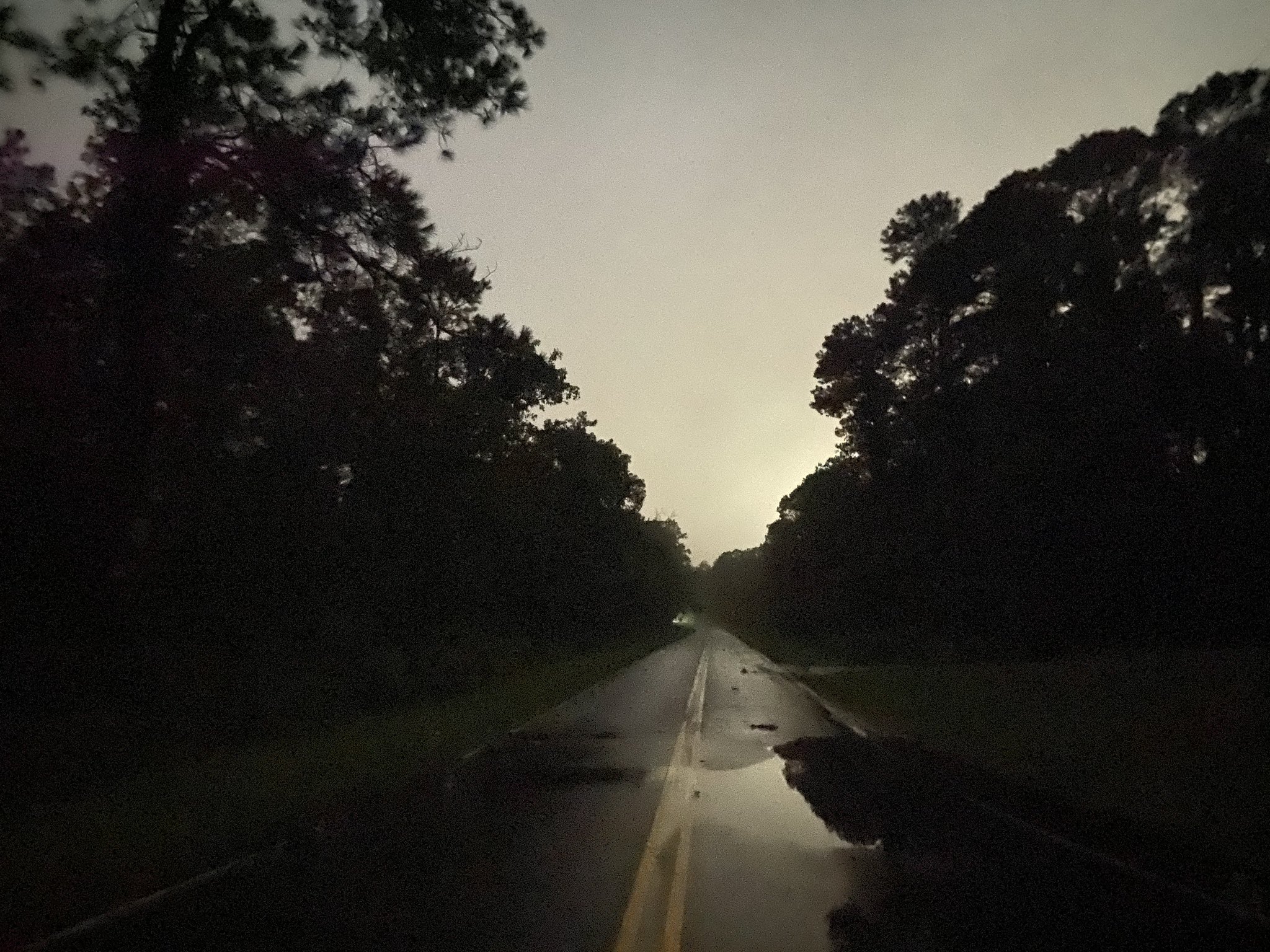
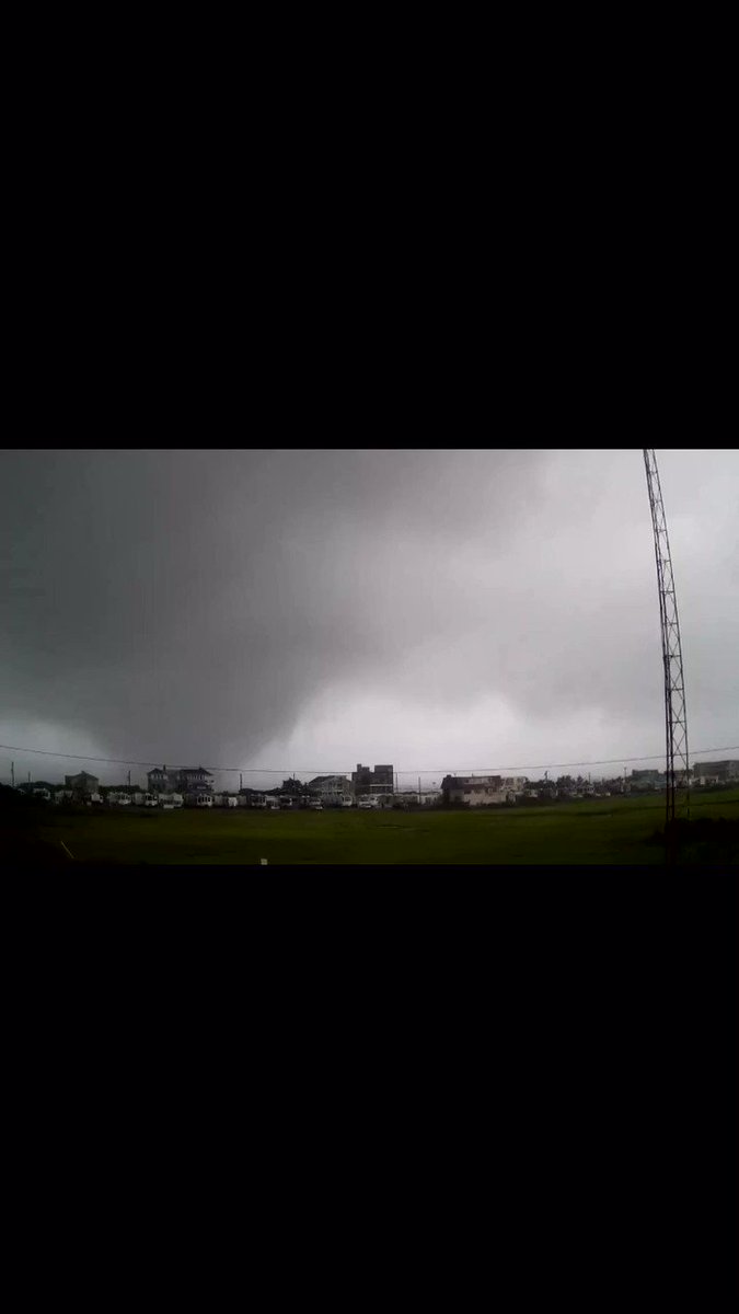
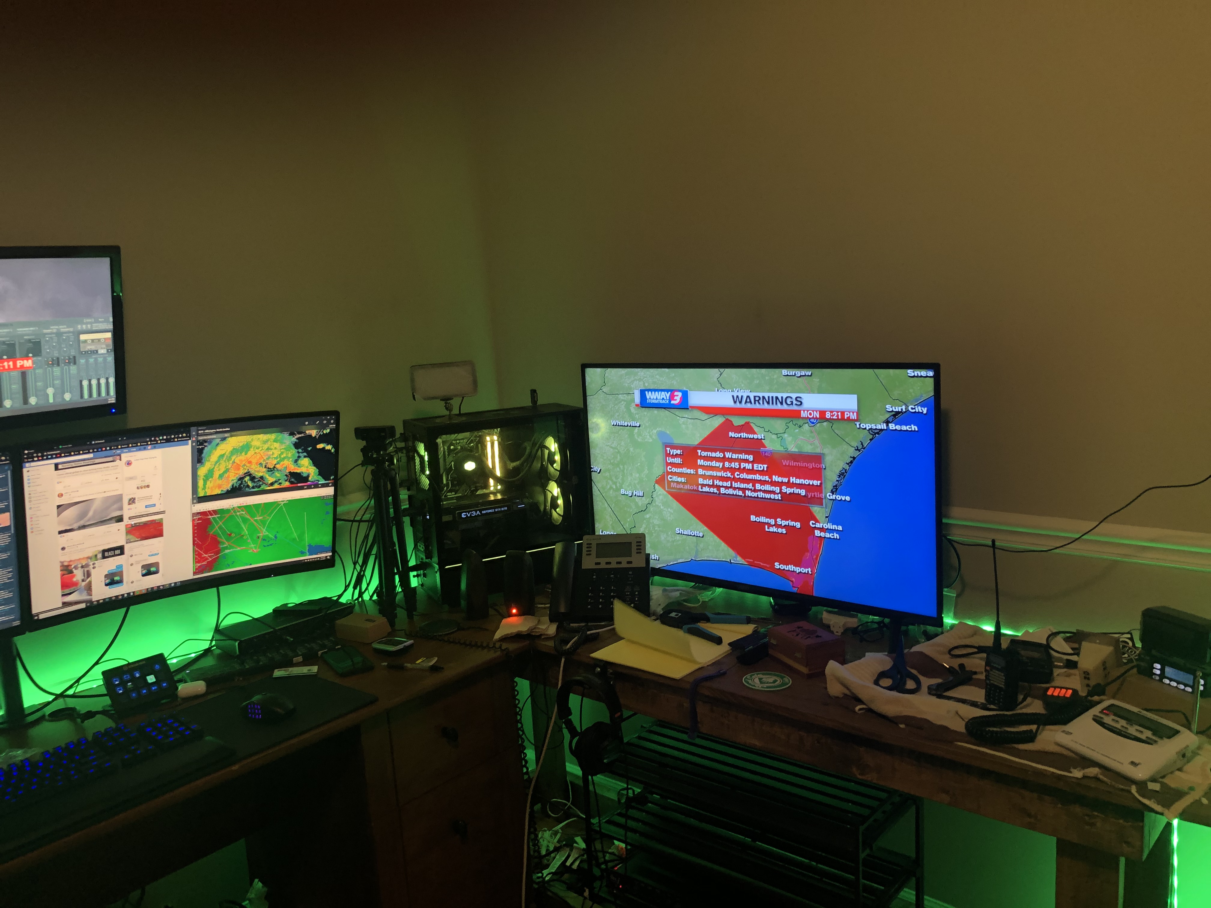
 #HurricaneIsaias #ncwx


 2
2

 3
3
 2
2


 2
2
 3
3
3
3

 3
3


 3
3
 2
2


 3
3


 3
3


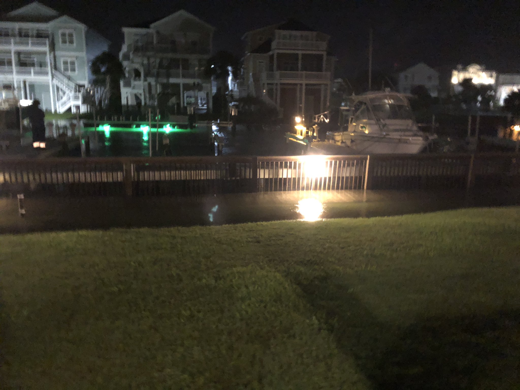


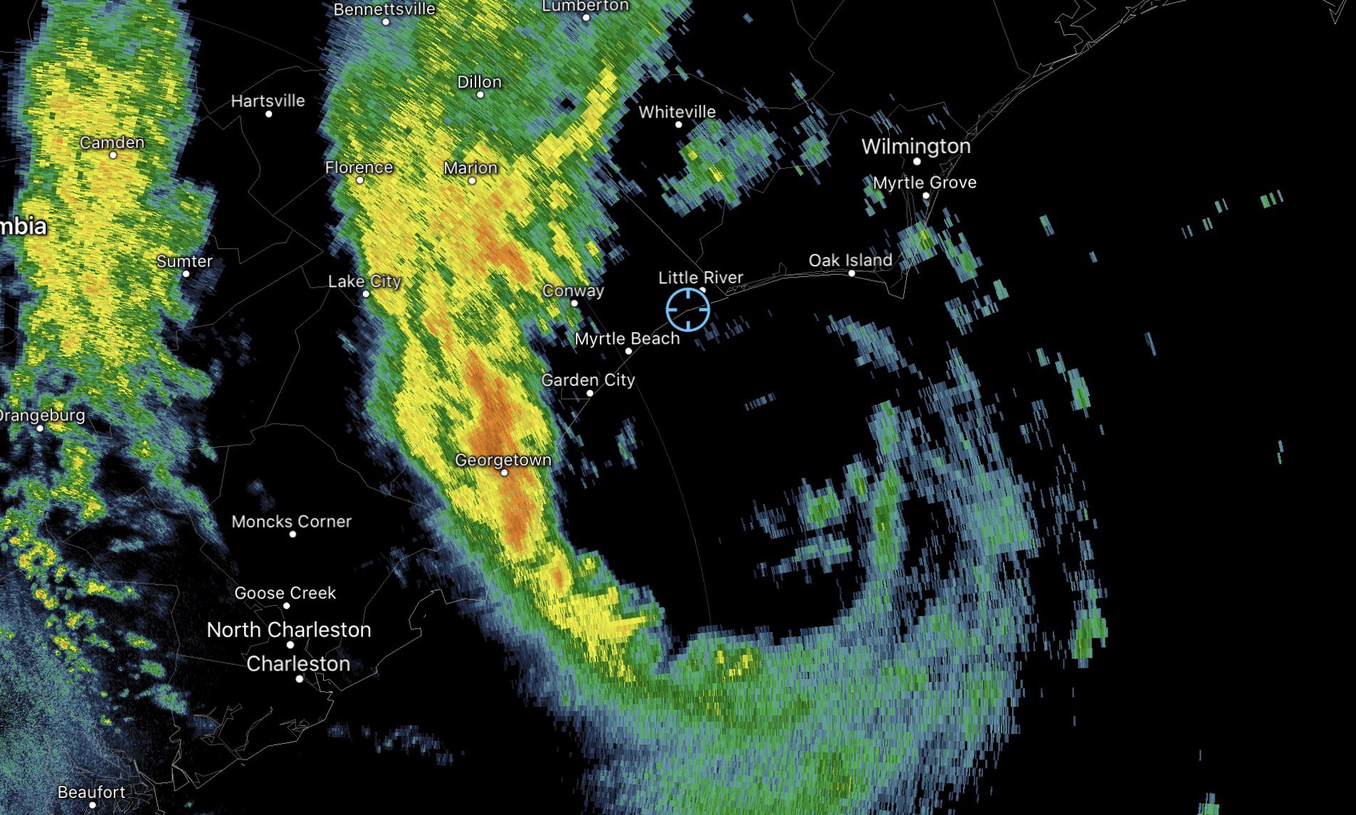
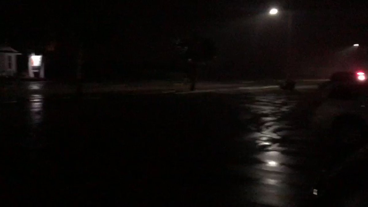
 ♂️ #Isaias