Stormtrack
EVENT ARCHIVE / hurricane-laura-2020
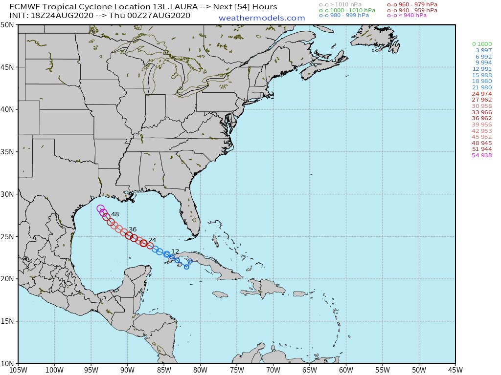
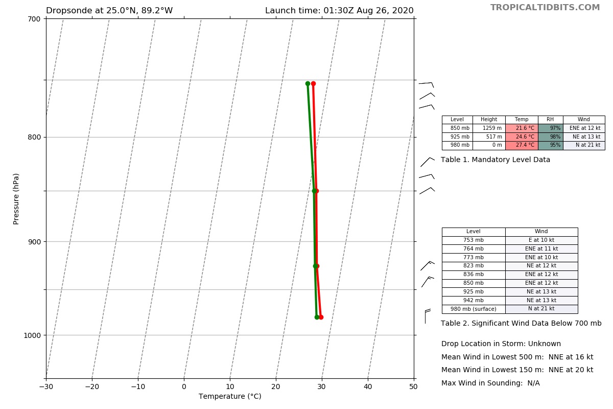
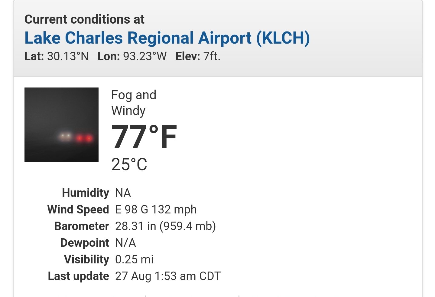
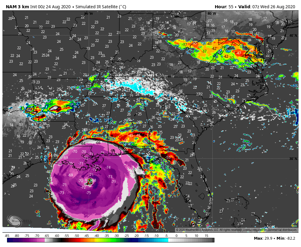
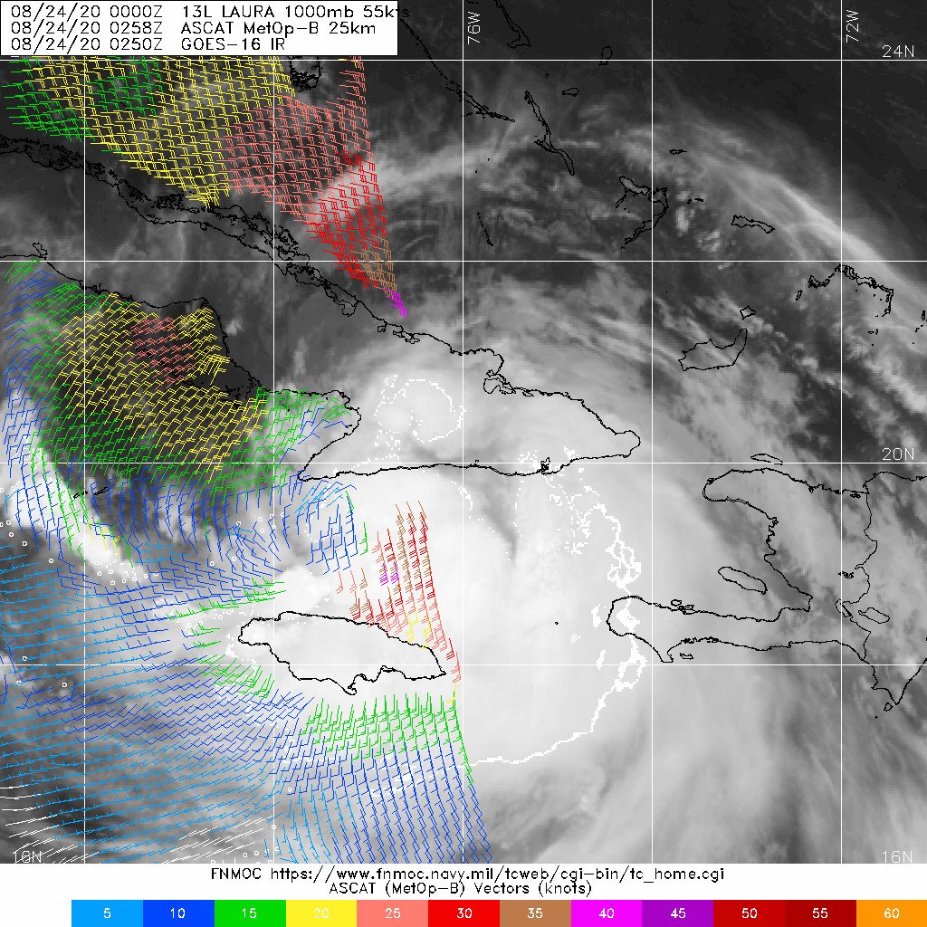
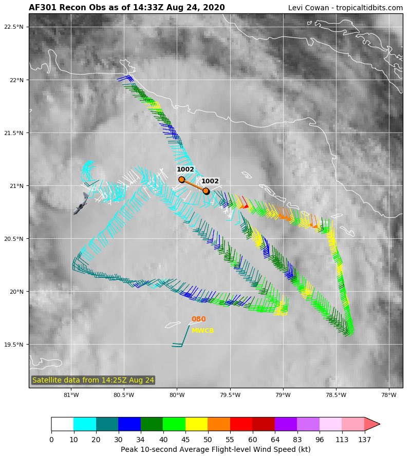
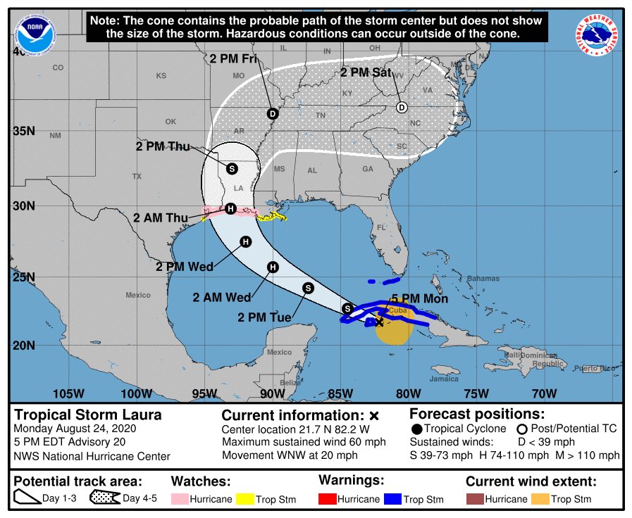
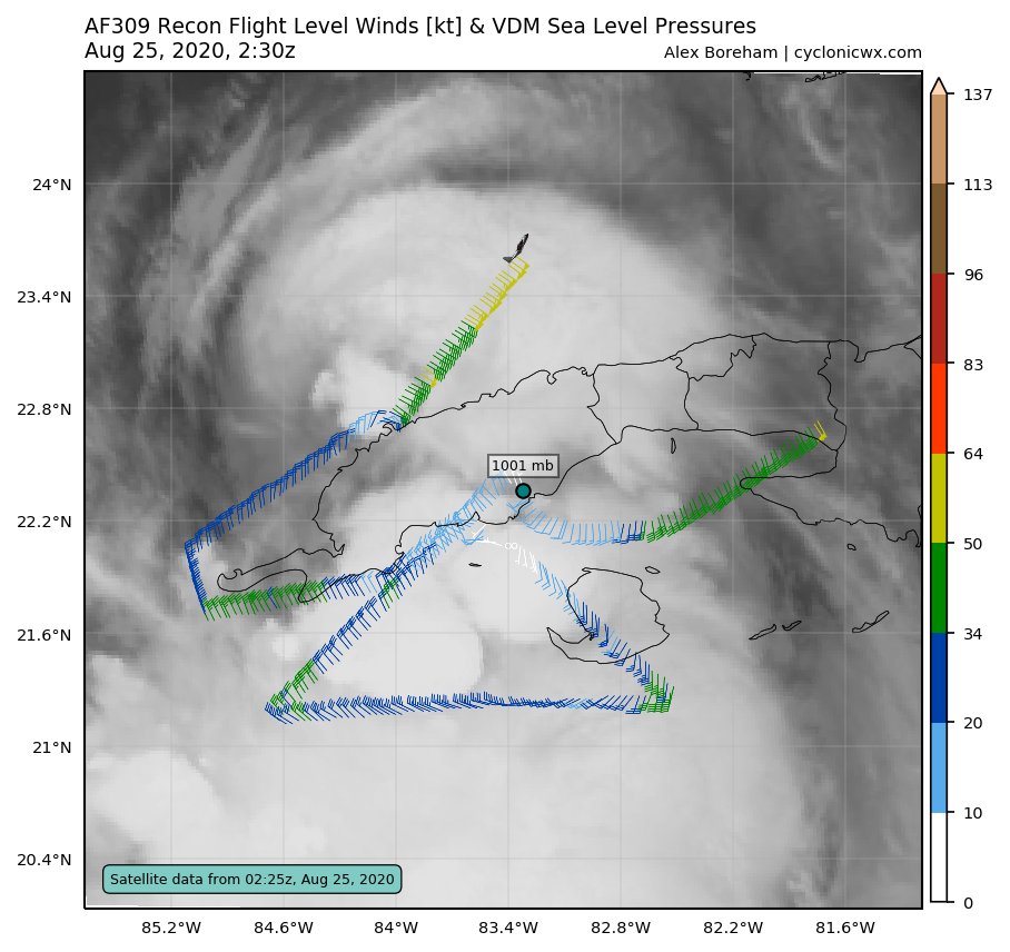
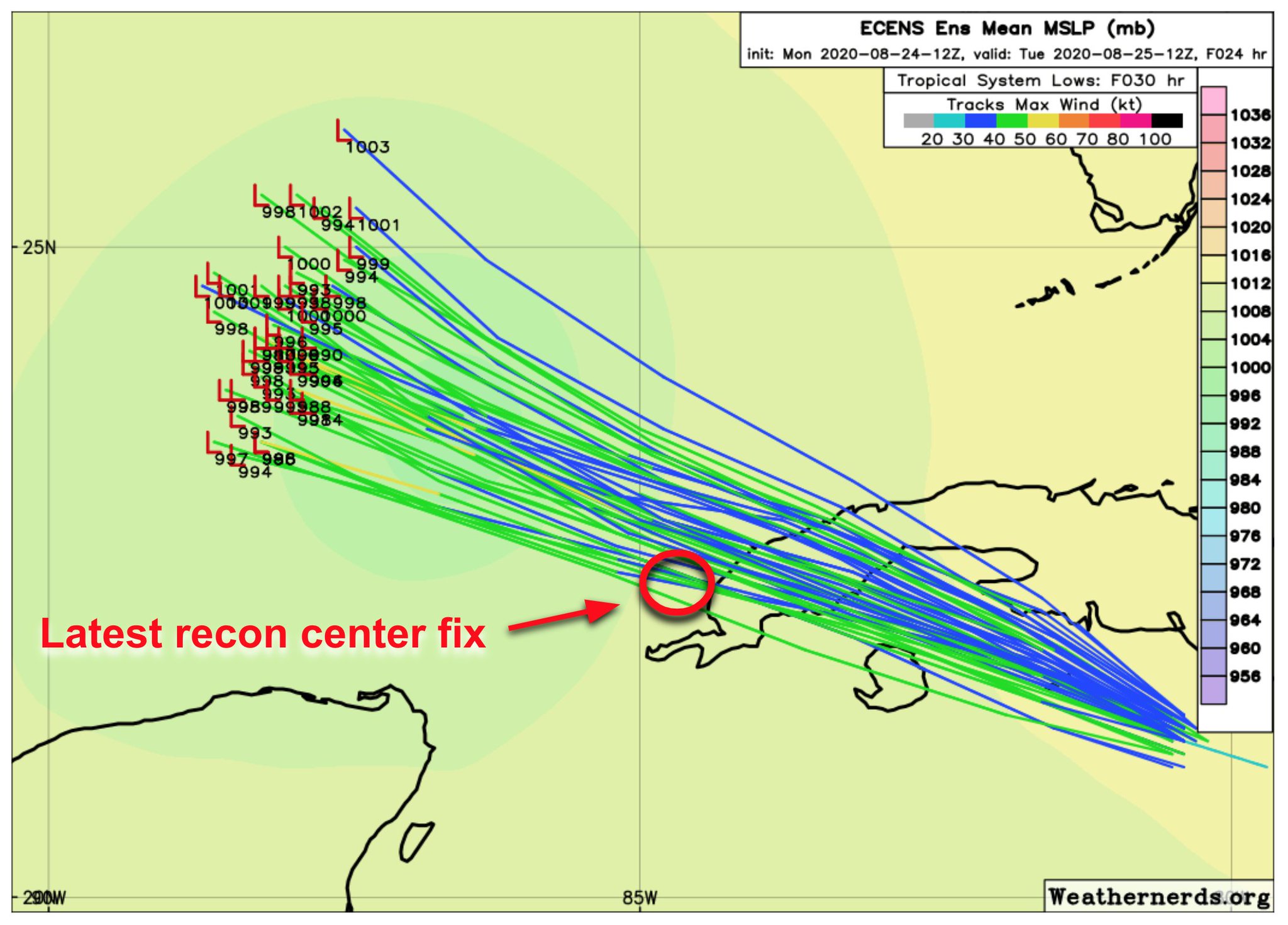
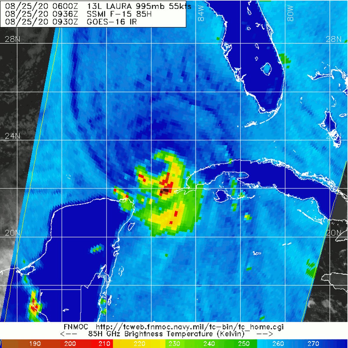
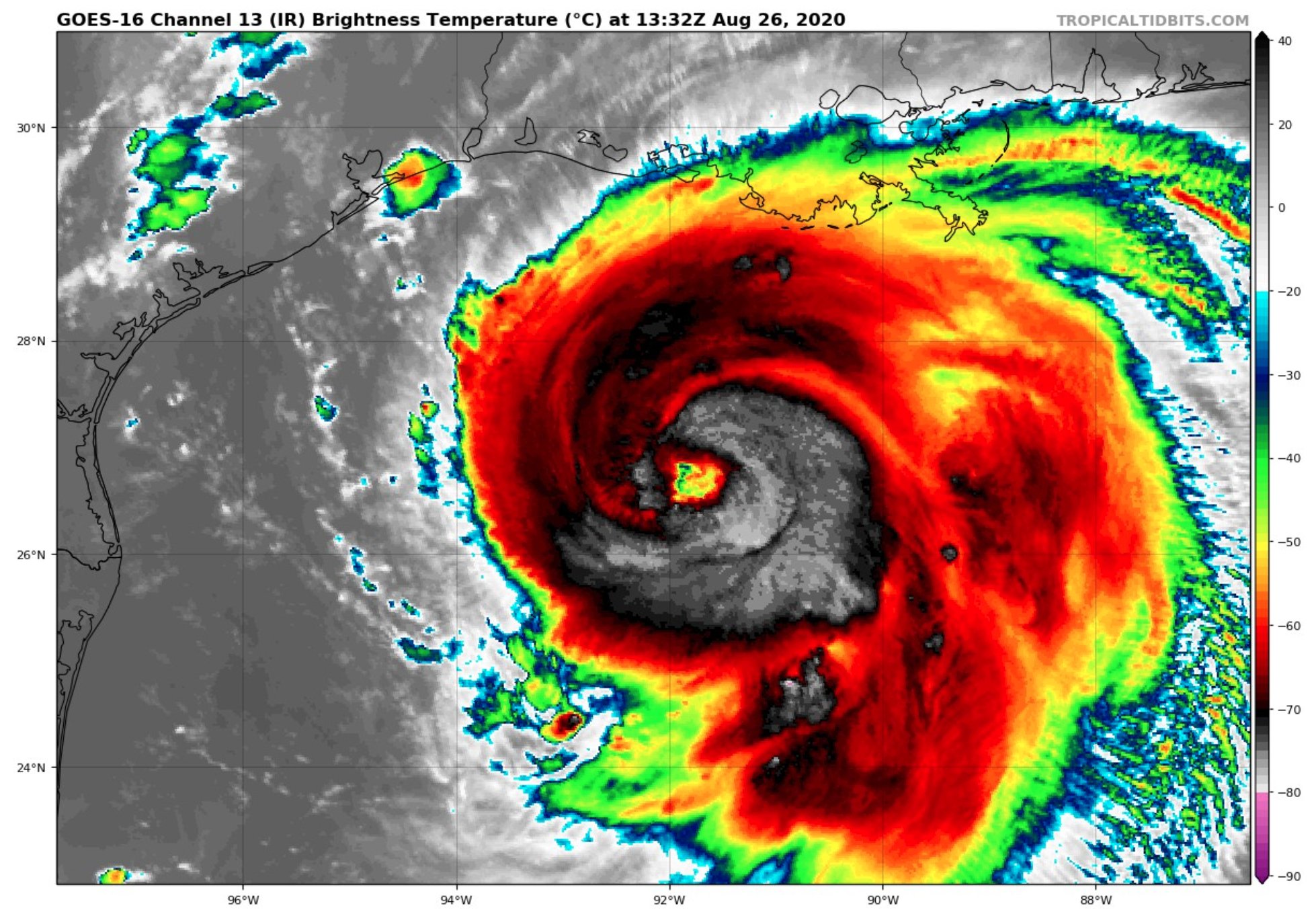
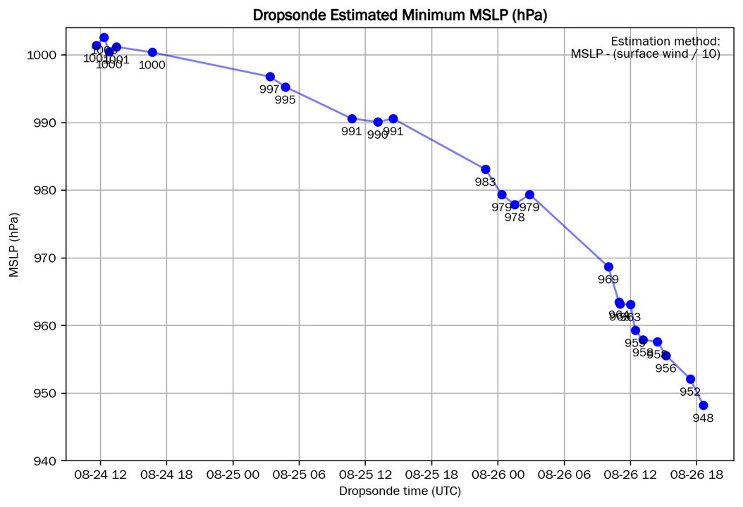
25 Aug 7:00 AM - 23.4N 86.4W, 70 MPH, WNW/290 @ 17 MPH, 991 MB


 1
1


 4
4


 1
1


 5
5
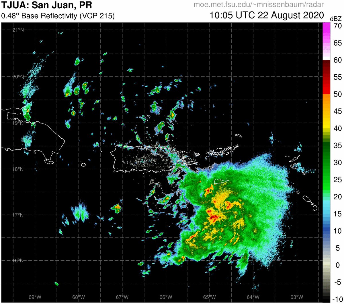
 Guayama: 58 mph (sustained|sostenidos)/67 mph (gust|ráfaga) (1:27 PM AST)
#prwx #usviwx
Guayama: 58 mph (sustained|sostenidos)/67 mph (gust|ráfaga) (1:27 PM AST)
#prwx #usviwx


 hasn't started calling this the double Covidcane dilemma
2
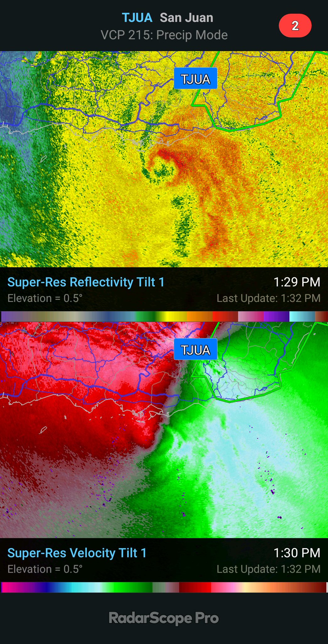
SALINAS: 75 mph (sustained|sostenidos)/75 mph (gust|ráfaga) (2:09 PM AST)
#prwx #usviwx
hasn't started calling this the double Covidcane dilemma
2
SALINAS: 75 mph (sustained|sostenidos)/75 mph (gust|ráfaga) (2:09 PM AST)
#prwx #usviwx SALINAS: 75 mph (75 mph (gust|ráfaga)) (2:09 PM AST)
#prwx #usviwx
SALINAS: 75 mph (75 mph (gust|ráfaga)) (2:09 PM AST)
#prwx #usviwx


 2
2
1
2
2
1

 3
3
 3
3
 3
3


 1
1
 1
1

 5
5


 1
1


 7
7


 5
5
 3
3
3
3
 4
2
4
2
 4
4


 6
6


 3
1
3
3
1
3


 1
1


 1
1


 6
6


 3
3
 1
1


 2
2


 3
3

 2
2
 6
6


 2
2


 6
4
6
4


 6
6

 5
5


 2
2

 1
3
1
3
 4
3
4
3

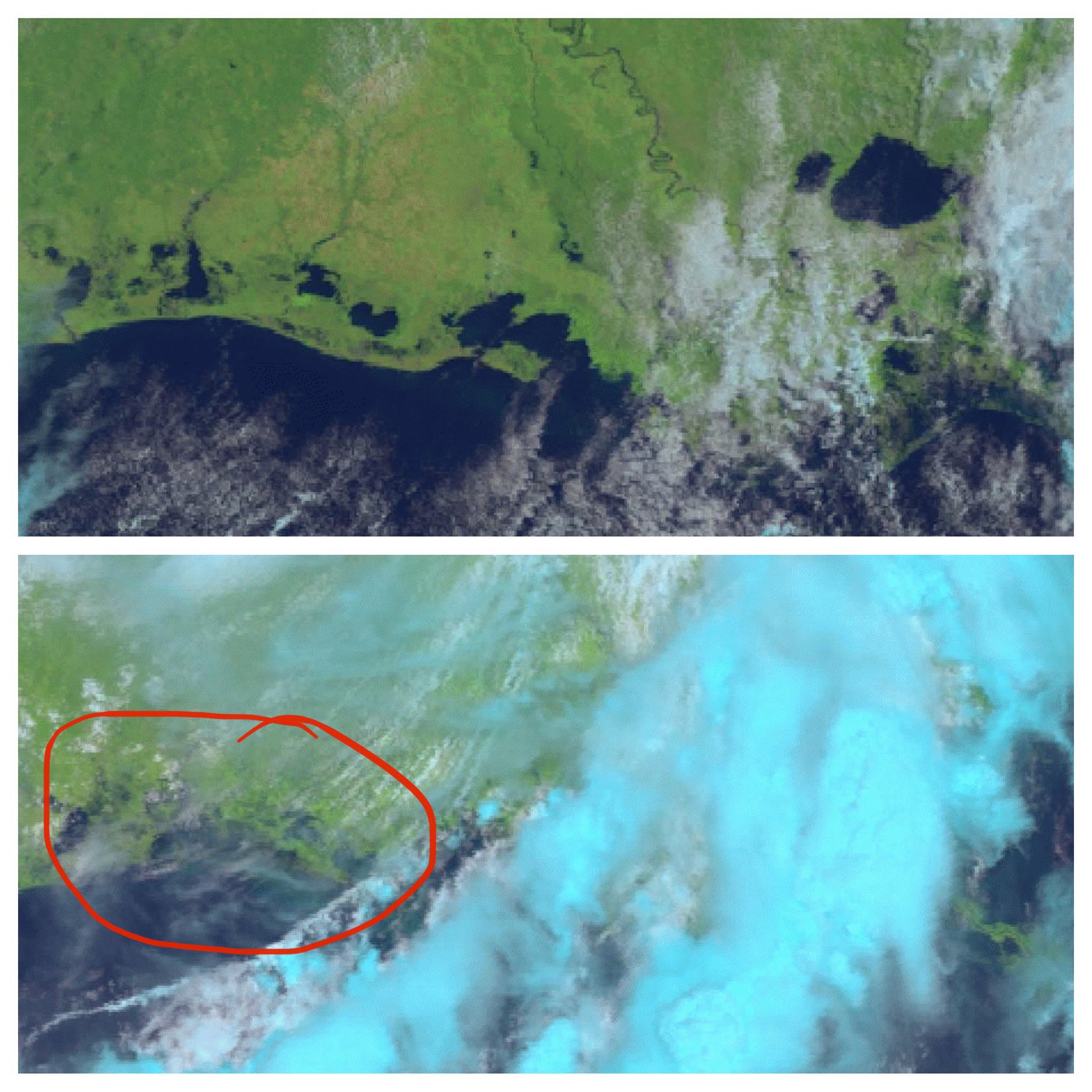
 ️ poke out before sunset


 3
3


 2
2


 2
2


 4
4
 2
2
 2
2


 2
2

 (edited)


 2
2


 1
1


 2
2


 3
3

 4
4
 (edited)


 3
3


 2
2


 2
2
 4
5
4
5
 6
4
6
4


 4
4
 3
5
3
5
 5
5
 4
4


 3
3

 5
8
5
8


 (edited)


 3
3


 4
1
4
1

 3
1
3
1
 5
5
 Nicole Marie & Joseph Woll
@HankAllenWX @WGNOtv @NWSNewOrleans
Nicole Marie & Joseph Woll
@HankAllenWX @WGNOtv @NWSNewOrleans
 6
2
6
2
6
2
6
2


 1
1


 1
1
 1
1
1
1
1
1


 2
1
2
3
5
2
1
2
3
5
 2
6
1
2
6
1

 8
8
 6
6


 1
1
 5
5
5
5
 4
7
5
4
7
5

 8
1
8
1
 7
7

 5
5


 2
2
 7
4
7
4
 4
4
4
4
 2
2
2
2
 8
3
3
3
8
3
3
3


 2
2


 2
5
2
5

 3
5
3
5

 1
1

 7
6
4
7
6
4

 1
1

 4
4


 4
4


 6
6
 2
2

 5
4
5
4


 1
1
 7
7


 4
4

 5
4
5
4


 5
5


 1
1


 3
3
 4
4

 5
5
 3
3
 5
4
3
5
4
3

 8
8


 5
5


 5
5


 3
3

 2
2

 a couple weeks ago.
 2
2
 7
1
7
1

 3
3
3
3

 2
2
2
2


 2
4
1
1
2
4
1
1
 2
2
 4
4

 2
2
 ♂️
♂️
 2
2
 5
5

 2
3
2
3
 3
9
11
1
3
9
11
1


 5
5


 4
6
4
6


 3
3
 2
2
 6
8
6
8


 6
6
 5
5
 5
5


 7
3
7
7
3
7
 4
3
4
3
 2
4
2
4

 2
2


 4
4


 8
8


 2
2


 5
5


 1
1

 4
4

 5
5

 3
1
3
1
 3
3

 3
10
3
10
 2
2

 3
2
3
2
 3
3
 4
4

 9
7
9
7
 2
6
4
5
2
6
4
5
 6
6


 8
8
 5
5
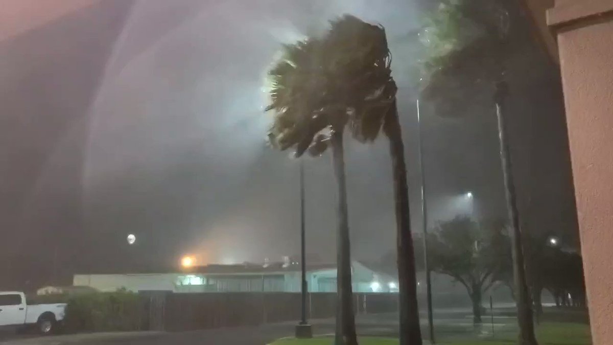
 just as the eye was about to come over
4
just as the eye was about to come over
4


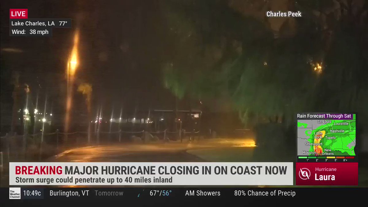
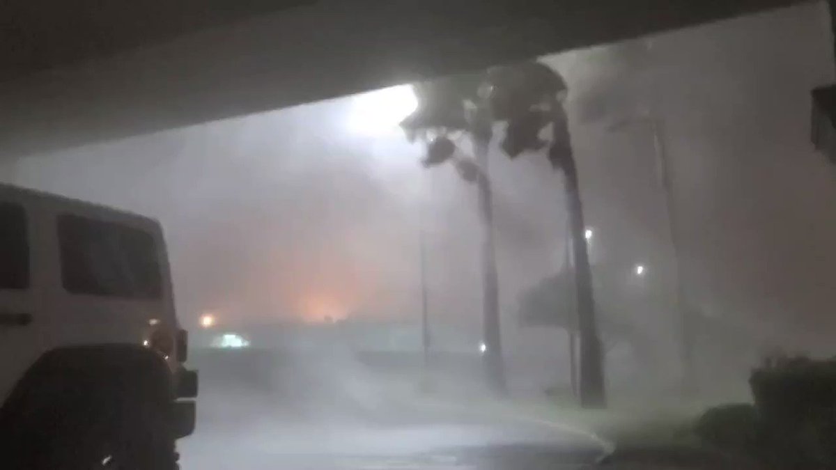
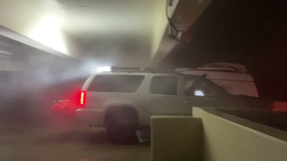
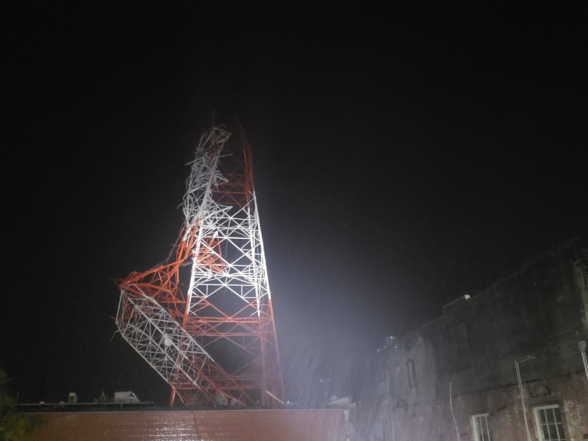
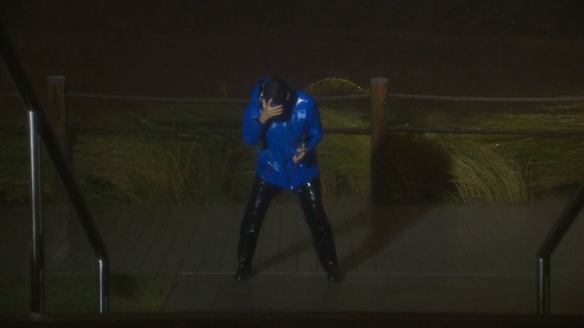
 SOUND UP
Listen to the wind inside this casino in Lake Charles as Hurricane Laura rips across the region with reports of winds over 120 mph! We're live with team coverage as the storm continues to impact the coastline and move inland.
#HurricaneLaura
#LAwx https://t.c...
SOUND UP
Listen to the wind inside this casino in Lake Charles as Hurricane Laura rips across the region with reports of winds over 120 mph! We're live with team coverage as the storm continues to impact the coastline and move inland.
#HurricaneLaura
#LAwx https://t.c...


 14
1
1
14
1
1

 6
6


 6
6

 2
2
 4
4

 8
8


 4
8
3
4
8
3

 2
2


 10
10
 4
4
 4
4
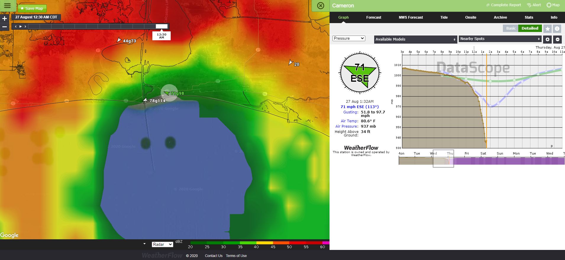
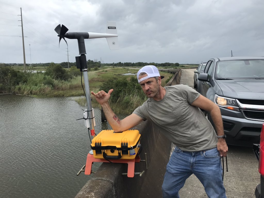
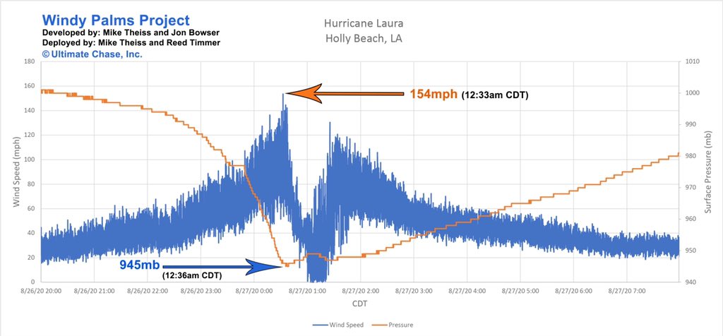
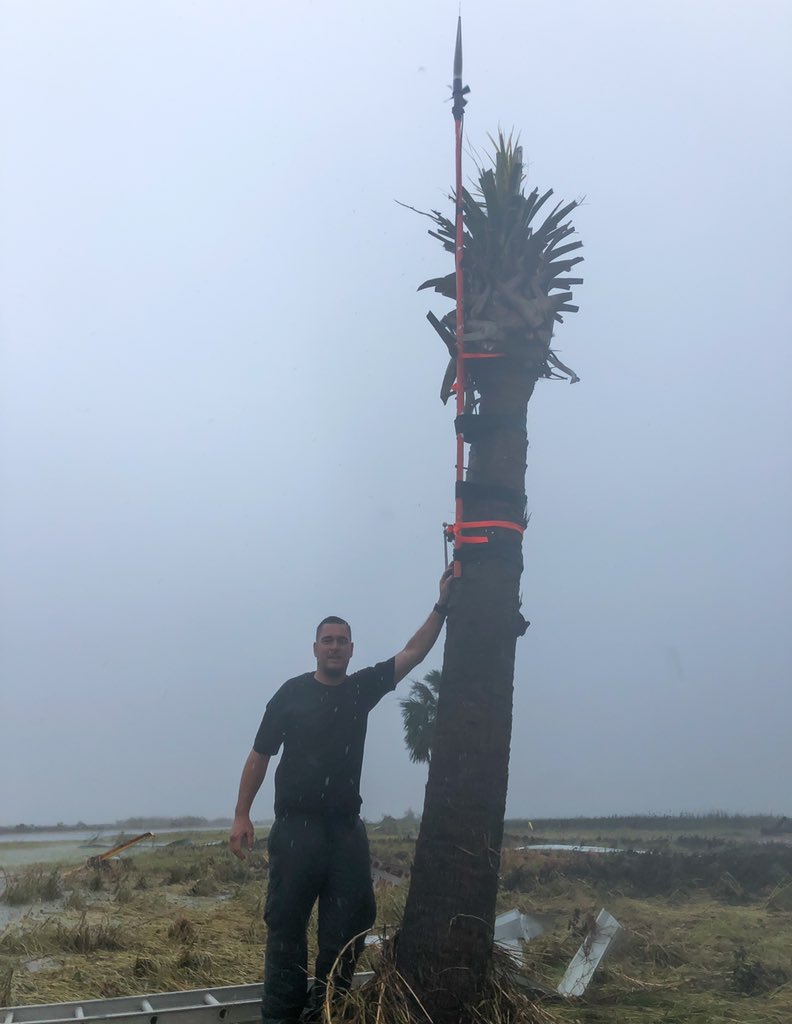
 I’ll have the data from the pressure sensor ASAP. Stay tuned, it could be historic!
 6
6
 6
4
4
5
10
4
6
4
4
5
10
4

 5
5