Guild icon
Stormtrack
EVENT ARCHIVE / 06-25-2021_il_mo_ks_ok_tx
Avatar
Glen Heinz (Greenville, SC) 24-Jun-21 02:19 PM
Let's the games Begin!
Avatar
Joey Prom (Lafayette, IN) 24-Jun-21 02:23 PM
I may take a stab, but idk. I am much more free saturday
Avatar
Matthew Gaylor (OKC, OK) 24-Jun-21 02:25 PM
Tomorrow is another boundary play, although it might go linear quickly.
Avatar
Joey Prom (Lafayette, IN) 24-Jun-21 02:30 PM
If there is a chance for discrete storm mode, within 2 hour drive, I may pounce on it. Otherwise I will hang out at my place with drinks and friends, then chase Saturday
Avatar
Jeff House (Chattanooga, TN) 24-Jun-21 04:42 PM
Outflow boundary again is worth a try Friday if one is already out here.
Avatar
Norman Smith (Racine, OH) 24-Jun-21 05:12 PM
North central IN @Joey Prom (Lafayette, IN)
I’m heavily considering chasing tomorrow
Avatar
Joey Prom (Lafayette, IN) 24-Jun-21 05:17 PM
ooh, where did u find that? I am going to make the decision day of. Got some social events I may go for
Storm mode is going to be the issue here
Avatar
Norman Smith (Racine, OH) 24-Jun-21 05:18 PM
Winamac area
Avatar
Joey Prom (Lafayette, IN) 24-Jun-21 05:18 PM
Its all going to depend on mesoscale boundaries
Avatar
Norman Smith (Racine, OH) 24-Jun-21 05:19 PM
They mention a MCV and some left over boundaries
And a 5% introduction
“and north of the effective warm front across a broad region from KS/MO into IL/IN. Moderate to locally strong instability and effective shear of 30-40 kt will favor multiple organized thunderstorm clusters capable of damaging winds and large hail. A seasonably strong low-level jet will also support sufficient low-level shear for some tornado threat, especially near any modifying outflow during the late afternoon and early evening. Uncertainty remains too high to delineate any 5% tornado probability areas with this outlook, though.”
Avatar
Joey Prom (Lafayette, IN) 24-Jun-21 05:21 PM
I am thinking We will need to go to IL to get the better storm mode
HRRR/RAP not keen on tomorrow, some risk in IL. Its all going to come down to day of stuff, classic midwest summer setup. Some of my best chases were day of decisions. Any chase this weekend is going to be messy and flooded. The Local NWS office here is warning about the flood risk along the Wabash river valley, up to 6 in of rain these next 36 hours in spots.
Avatar
Norman Smith (Racine, OH) 24-Jun-21 05:28 PM
Northern IN mentions a tornado threat
Avatar
Joey Prom (Lafayette, IN) 24-Jun-21 05:28 PM
I have yet to chase a true tornado setup in IN, if you can believe that.
Avatar
Norman Smith (Racine, OH) 24-Jun-21 06:05 PM
Lets go
Avatar
Matthew Gaylor (OKC, OK) 24-Jun-21 10:24 PM
We can do this again tomorrow, with less of a tornado threat, and just chase the mess.
Avatar
Nathan M (Neosho, Mo) 24-Jun-21 10:29 PM
I have to teach morning summer school. I’ll see how I feel after that and a couple coffees
Avatar
Joey Prom (Lafayette, IN) 24-Jun-21 11:29 PM
NAM/NAM3k like tomorrow and Saturday. RAP/HRRR want a big mess of nothing severe.
Avatar
Josh Zitko(St Louis, MO) 24-Jun-21 11:34 PM
Hm, could potentially have time to chase tomorrow. Have a lot of packing to do.
Avatar
Joey Prom (Lafayette, IN) 24-Jun-21 11:37 PM
I will hopefully get off work at around 21z. We will have to see what the OFBs develop like. I am hoping the NAM solution is right and the dry air currently in place just kills off the morning MCS. Then we get a nice primed environment as the stalled front slowly shifts east. We will have this same pattern for the foreseeable future, so opportunities each day. But mostly lots of training storms and rain.
Avatar
Royce Sheibal (Papillion,NE) 25-Jun-21 12:05 AM
Possible low topped supers near the low tomorrow here locally. Gonna be interesting to see how the cape sets up
Avatar
TJ (Houston/Galveston TX) 25-Jun-21 12:08 AM
They got me interested after they decided to add Amarillo to the slight risk. Might get to play a little in the afternoon
Avatar
Norman Smith (Racine, OH) 25-Jun-21 07:52 AM
Today we chase
Avatar
Jeff House (Chattanooga, TN) 25-Jun-21 08:16 AM
Illinois and Indiana could recover this afternoon. MCV looks Michigan bound, but still a boundary and shear back over the rest of the Midwest. Chase parter and I are in KC this morning. We chase the Kansas quick blob. Might not be instant mess, but it will become a mess fairly quickly. Therefore I call it the quick blob chase. Leaning east-central Kansas. While it’d be nice to visit Wichita, south-central Kansas is the nutty hot zone surface and aloft. Storm environment should be better eastern Kansas. (edited)
Avatar
Norman Smith (Racine, OH) 25-Jun-21 08:19 AM
This MCV is taking the same path as 8/24/16 which is interesting
Also almost same Synoptics as well
Avatar
Joey Prom (Lafayette, IN) 25-Jun-21 08:28 AM
Norman what are your thoughts? It still looks like a mess to me. NAM 3k continues to really like N IN, but HRRR continues to not think much of today.
Avatar
Norman Smith (Racine, OH) 25-Jun-21 08:28 AM
HRRR is a poopy model
Today we chase
Avatar
Joey Prom (Lafayette, IN) 25-Jun-21 08:31 AM
We will have to communicate, may have to negotiate a meetup. I cannot get of work until 21z, so hopefully the IN play materializes
Avatar
Nathan M (Neosho, Mo) 25-Jun-21 09:03 AM
I’m only playing East Kansas because it’s an hour from home. I don’t have high hopes but I’ve scored on days like that
Avatar
Joey Prom (Lafayette, IN) 25-Jun-21 09:06 AM
Northern IN office makes no mention of anything but flooding. They are going with the HRRR solution
Central IN office is the only one around here who mentions the severe risk much: "BY LATE AFTERNOON AND EARLY EVENING...MAY SEE A BIT OF A LULL IN THE WAKE OF THE EARLIER STORMS BEFORE ADDITIONAL CONVECTION FIRES WITH MORE ENERGY ALOFT ROLLING INTO THE REGION. THERE APPEARS TO BE A NARROW WINDOW DURING THE EARLY TO MID EVENING WHERE A CONDITIONAL SEVERE WEATHER RISK MAY EXIST. DAMAGING WINDS WOULD BE THE PRIMARY THREAT...BUT LAYING IN THE WEEDS IS A SNEAKY TORNADO RISK WITH HODOGRAPHS SHOWING A FEW HOURS WITH 0-1KM SRH VALUES UP TO 200 M2/S2. THE PROBLEMS THOUGH IS LIMITED INSTABILITY AND OVERALL POOR LAPSE RATES THAT WOULD MARGINALIZE CONVECTIVE INTENSITY. THAT BEING SAID...HAVE SEEN THIS SETUP ALIGN BEFORE IN THE PRESENCE OF A DEEP TROPICAL AIRMASS WHERE LCLS CAN DIP BELOW 3KFT. NOT SURE WE CAN GET LCLS QUITE THAT LOW BUT IT IS CLOSE FOR A SHORT PERIOD OF TIME. THIS WILL BE SOMETHING TO MONITOR THROUGH THE DAY"
Who is ready to chase a tropical tornado setup... in Central Indiana...
Avatar Nathan M (Neosho, Mo)
I’m only playing East Kansas because it’s an hour from home. I don’t have high hopes but I’ve scored on days like that
Avatar
Matthew Gaylor (OKC, OK) 25-Jun-21 09:10 AM
Find a boundary and stay north of it.
Avatar
Matthew Gaylor (OKC, OK) 25-Jun-21 09:18 AM
I’m throwing models out the window today in KS. Hard to use them when you are playing an OFB and they have the OFB in different spots.
Avatar
Norman Smith (Racine, OH) 25-Jun-21 09:18 AM
NWS asleep today
When they’re asleep you eat
Avatar
Matthew Gaylor (OKC, OK) 25-Jun-21 09:20 AM
SPC’s write up was fairly well. Basically, we’re going wide slight because we can’t pin down where certain mesoscale spots will be, but wherever those are, that’s where you’ll have better chances of supercells.
Avatar
Joey Prom (Lafayette, IN) 25-Jun-21 10:10 AM
Latest CAM runs are total garbage.
Avatar
Norman Smith (Racine, OH) 25-Jun-21 10:14 AM
HRRR actually up trended
Avatar
Joey Prom (Lafayette, IN) 25-Jun-21 10:17 AM
HRRR did a bit, but NAM downtrended hard.
Find the boundary and hope for semi discrete
Avatar
Norman Smith (Racine, OH) 25-Jun-21 10:20 AM
^
MCV’s in the Midwest you never skip
Avatar Jeff House (Chattanooga, TN)
Illinois and Indiana could recover this afternoon. MCV looks Michigan bound, but still a boundary and shear back over the rest of the Midwest. Chase parter and I are in KC this morning. We chase the Kansas quick blob. Might not be instant mess, but it will become a mess fairly quickly. Therefore I call it the quick blob chase. Leaning east-central Kansas. While it’d be nice to visit Wichita, south-central Kansas is the nutty hot zone surface and aloft. Storm environment should be better eastern Kansas. (edited)
Avatar
Matthew Gaylor (OKC, OK) 25-Jun-21 10:20 AM
I'll probably be in Emporia area. Gives me option back to the NE and also allows me to go home to OKC fairly easily (edited)
👍 1
Avatar
Norman Smith (Racine, OH) 25-Jun-21 10:39 AM
Avatar
Norman Smith (Racine, OH) 25-Jun-21 10:46 AM
Avatar
Joey Prom (Lafayette, IN) 25-Jun-21 10:47 AM
I am leaning towards not chasing atm. I really don't want to forgo a social opportunity with my friends for chasing rain showers. But if we start to get more discrete initiation on the CAMs I may give it a go
Avatar
Matthew Gaylor (OKC, OK) 25-Jun-21 10:47 AM
Gonna be right next to it if it produce to see it with those LCLs
Can practically jump and hit the clouds
Avatar
Joey Prom (Lafayette, IN) 25-Jun-21 10:51 AM
Time for some EF0 wedges
Avatar Joey Prom (Lafayette, IN)
Time for some EF0 wedges
Avatar
Nathan M (Neosho, Mo) 25-Jun-21 11:16 AM
Like Happy. Still fun to see
Avatar
Joey Prom (Lafayette, IN) 25-Jun-21 12:17 PM
I don't think I am going chasing today, but I will wait to make the final call until the SPC releases their 1630z update.
Avatar
Jacob Melton (Owosso, MI) 25-Jun-21 12:17 PM
Of course we're just gonna have to wait for the SPC site to update today
this 5
Avatar
Joey Prom (Lafayette, IN) 25-Jun-21 12:18 PM
The Great COD Meltdown of '21
Avatar
Joey Prom (Lafayette, IN) 25-Jun-21 12:29 PM
Its that time boys...
Avatar
Norman Smith (Racine, OH) 25-Jun-21 12:32 PM
I mean
Avatar
Joey Prom (Lafayette, IN) 25-Jun-21 12:37 PM
I find the Lack of UH tracks disturbing
Avatar
Matthew Gaylor (OKC, OK) 25-Jun-21 12:38 PM
SPC waiting on cod
Yao 6
Avatar
Joey Prom (Lafayette, IN) 25-Jun-21 12:39 PM
Now the truth is known to all, even the SPC uses COD (edited)
Avatar
Matthew Gaylor (OKC, OK) 25-Jun-21 12:40 PM
That’s why cod always updates before the SPC site.
this 3
thonk 2
Avatar
Joey Prom (Lafayette, IN) 25-Jun-21 12:44 PM
I am not anticipating any major changes tbh
Avatar
Matthew Gaylor (OKC, OK) 25-Jun-21 12:49 PM
Slight risk for everyone.
It just updated.
Avatar
Joey Prom (Lafayette, IN) 25-Jun-21 12:50 PM
not 4 me
Avatar
Matthew Gaylor (OKC, OK) 25-Jun-21 12:51 PM
Sent in chat.
All of them read slight.
Avatar
Norman Smith (Racine, OH) 25-Jun-21 12:54 PM
O h (edited)
That slight in NW OH
Avatar
Matthew Gaylor (OKC, OK) 25-Jun-21 12:55 PM
Yep marginal Indians, slight Ohio.
Avatar
Joey Prom (Lafayette, IN) 25-Jun-21 12:55 PM
RIP me, oh well. I will be chasing whatever happens tomorrow
Avatar
Norman Smith (Racine, OH) 25-Jun-21 12:57 PM
@Joey Prom (Lafayette, IN) youre chasing CatRee
Avatar
Matthew Gaylor (OKC, OK) 25-Jun-21 12:58 PM
MD out for KS
60% chance of watch.
Avatar
Nathan M (Neosho, Mo) 25-Jun-21 01:07 PM
First blip not far from my place
Avatar
Norman Smith (Racine, OH) 25-Jun-21 01:08 PM
Defiance Ohio
MCV magic ladies and gents
Avatar
Joey Prom (Lafayette, IN) 25-Jun-21 01:10 PM
I have decided to remain indecisive and try for the best of both. I am hosting an event at my place at 7:30, which will allow me a 2 hour window to chase anything local.
Avatar
Jeff House (Chattanooga, TN) 25-Jun-21 02:05 PM
MD 1092 Iowa trolls
Avatar
Norman Smith (Racine, OH) 25-Jun-21 02:08 PM
Avatar
Jacob Punch (Kansas City) 25-Jun-21 03:08 PM
Anyone got the hodo for keax or ktwx
I’m at work
Avatar
TJ (Houston/Galveston TX) 25-Jun-21 03:44 PM
Yay, I'm in a watch. (Amarillo)Yao 
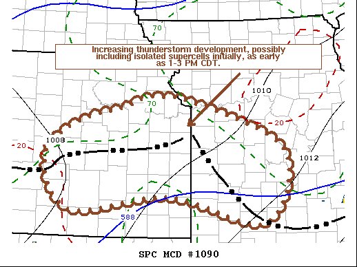
Tons of watches now TX-Missouri
Avatar
Joey Prom (Lafayette, IN) 25-Jun-21 03:50 PM
Now NAM3k is back to showing discrete initiation in IN. Man, if this run is true I will be in for a field day!
This run is spicy
Avatar
Nathan M (Neosho, Mo) 25-Jun-21 04:37 PM
Well that was fun. I’m gonna grab some Chicken Annie’s and head for the house. I’ve barely slept since yesterday’s episode.
Avatar
Joey Prom (Lafayette, IN) 25-Jun-21 07:41 PM
I chased, I saw (nothing), I came home
this 3
Avatar
Cody D. (Lincoln, NE - UNL) 25-Jun-21 08:00 PM
Nice play on the Latin phrase lol
Veni, Vici, Vidi.
this 2
Avatar
Matthew Gaylor (OKC, OK) 25-Jun-21 09:48 PM
I figured the wind would hit some town or city, but wanted to go home, so didn't stick around to see the damage Newton KS took. There was rotation on the storm near Florence earlier today, but it was mainly high based, so wasn't worth reporting, as I knew it wasn't going to produce. Was cool to watch though, less than a mile away.
Avatar
Matthew Gaylor (OKC, OK) 25-Jun-21 10:13 PM
I'll probably chase tomorrow again as well, depending on what this MCV does near dodge, and if it sends the OFB through OKC tonight or not
Avatar
Drake Anthony (Peoria, IL) 26-Jun-21 12:38 AM
I think I caught 3 brief spinup tornadoes in the chonker of a cell near Lincoln, IL
earlier that is
Exported 105 message(s)