Stormtrack
EVENT ARCHIVE / 07-14-2021_mn_wi_sd_ia

 3
3
")

")

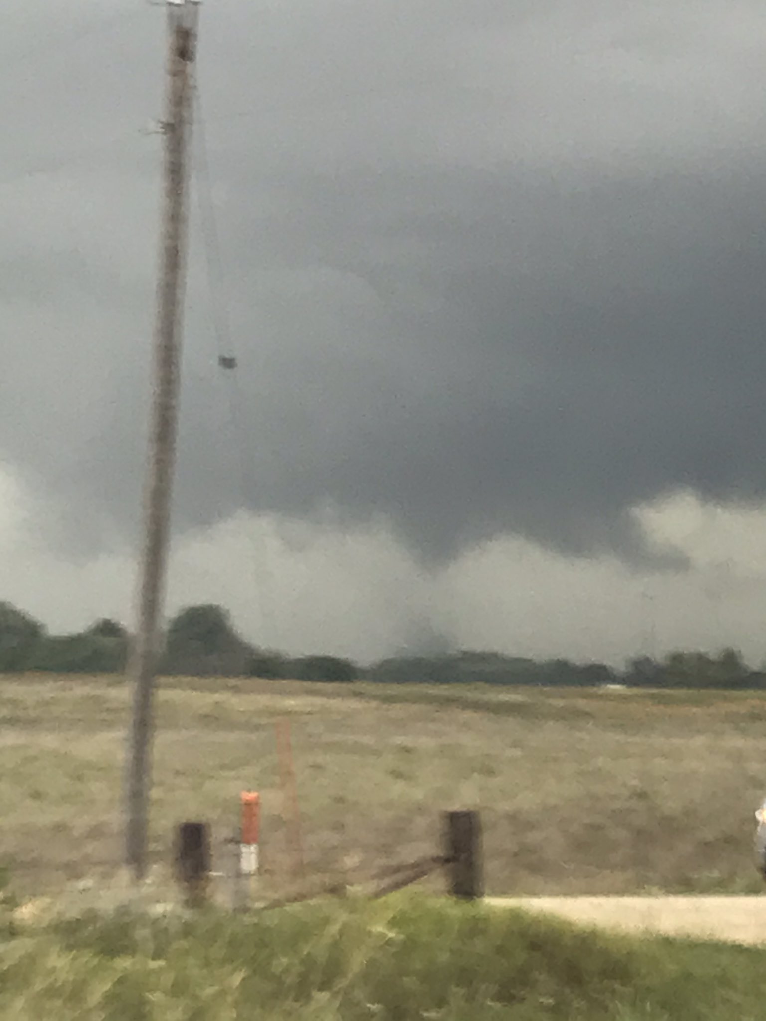
 Brennen Round (Chatfield, MN)


")
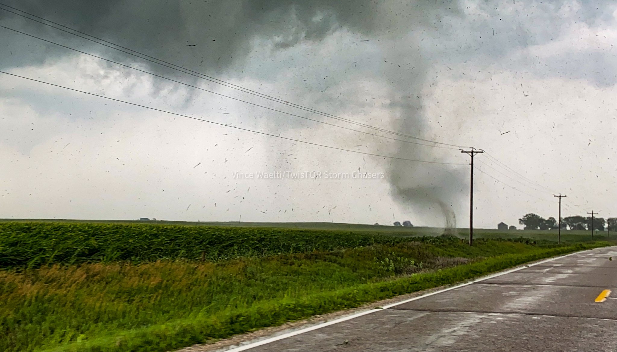
") Royce Sheibal (Papillion,NE)
Royce Sheibal (Papillion,NE)


")
 2
2
")
")
")
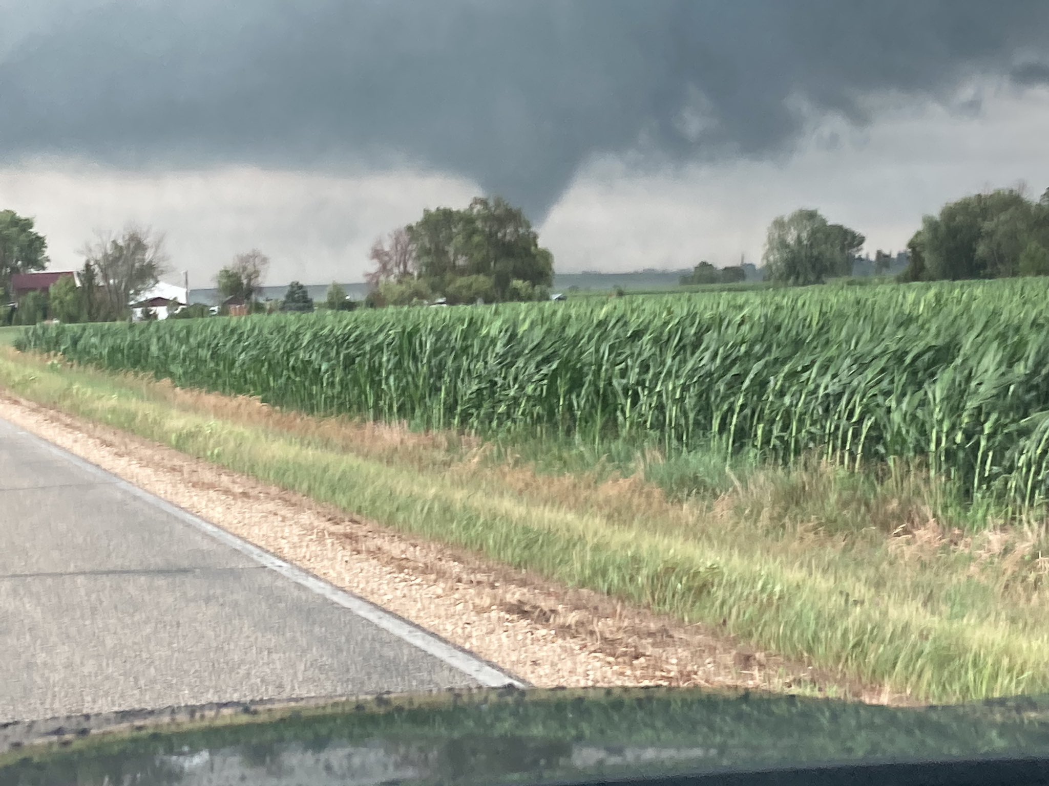
 Joey Prom (Lafayette, IN)

 1
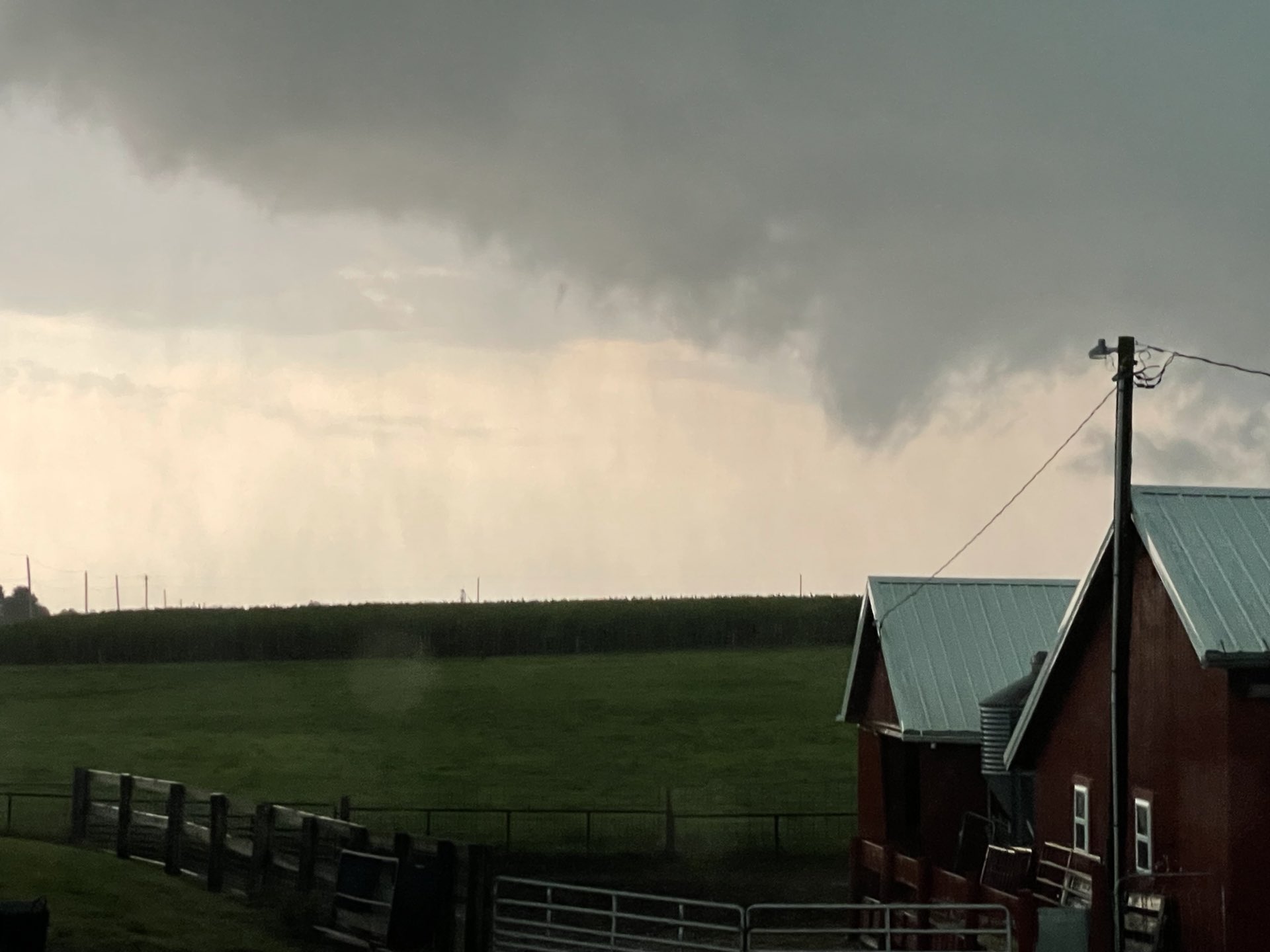
TJ (Houston/Galveston TX)
1
TJ (Houston/Galveston TX)
") 3
Royce Sheibal (Papillion,NE)
3
Royce Sheibal (Papillion,NE)
") Brennen Round (Chatfield, MN)
Brennen Round (Chatfield, MN)
 (edited)
Ben Holcomb (Norman OK)
(edited)
Ben Holcomb (Norman OK)

")
")
") Joey Prom (Lafayette, IN)
Joey Prom (Lafayette, IN)

") Joey Prom (Lafayette, IN)
2
Joey Prom (Lafayette, IN)
2
")
")
")
 me in
me in
 Joey Prom (Lafayette, IN)
2
Joey Prom (Lafayette, IN)
2

")
")

 tomorrow turns into
2
tomorrow turns into
2
 Nathan M (Neosho, Mo)
 Royce Sheibal (Papillion,NE)

")
")

")
")
")
")
")
")
")
")
") Kyle (Wayzata, MN)
Cameron (KMXX | GA)
Kyle (Wayzata, MN)
Cameron (KMXX | GA)
")
")
")
")
")
")
")
")
")

")

")
")

")
 Kyle (Wayzata, MN)
") Cameron (KMXX | GA)
Cameron (KMXX | GA)
 1
1
")
")
") Brennen Round (Chatfield, MN)
Brennen Round (Chatfield, MN)
")
")
") Royce Sheibal (Papillion,NE)
Royce Sheibal (Papillion,NE)
")
") Royce Sheibal (Papillion,NE)
Royce Sheibal (Papillion,NE)
")
")
")
")
")
")
")

 4
4

") Kyle (Wayzata, MN)
Kyle (Wayzata, MN)
")
")
 Cody D. (Lincoln, NE - UNL)
") 3
3

")

")

")

") Cody D. (Lincoln, NE - UNL)
4
Cody D. (Lincoln, NE - UNL)
4
") Cameron (KMXX | GA)
Cameron (KMXX | GA)
") Jacob Melton (Owosso, MI)
1
Jacob Melton (Owosso, MI)
1

")
") 1
1
")
")
")
")
")
")
") 3
3
")
 nobody gives a second look
")
 ?
?
")
") Cameron (KMXX | GA)
Cameron (KMXX | GA)
 2
2
")
") 1
Cody D. (Lincoln, NE - UNL)
1
Cody D. (Lincoln, NE - UNL)


")
")
 1
1
")
")
")
 3
3
") Jacob Melton (Owosso, MI)
Jacob Melton (Owosso, MI)
")

")
")
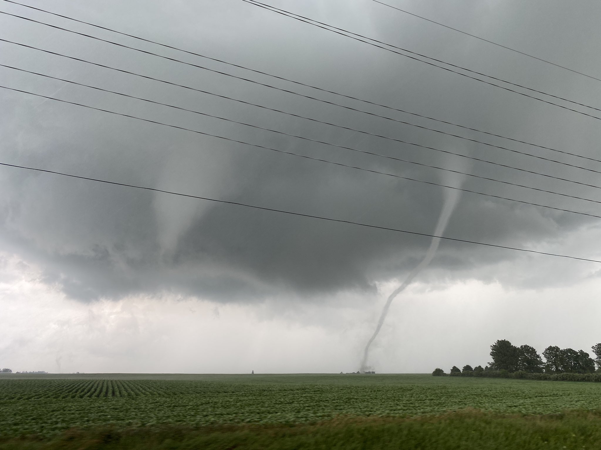
 Royce Sheibal (Papillion,NE)
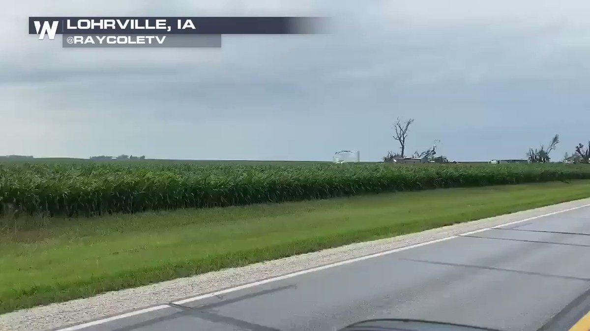
Cody D. (Lincoln, NE - UNL)
Royce Sheibal (Papillion,NE)
Royce Sheibal (Papillion,NE)
Cody D. (Lincoln, NE - UNL)

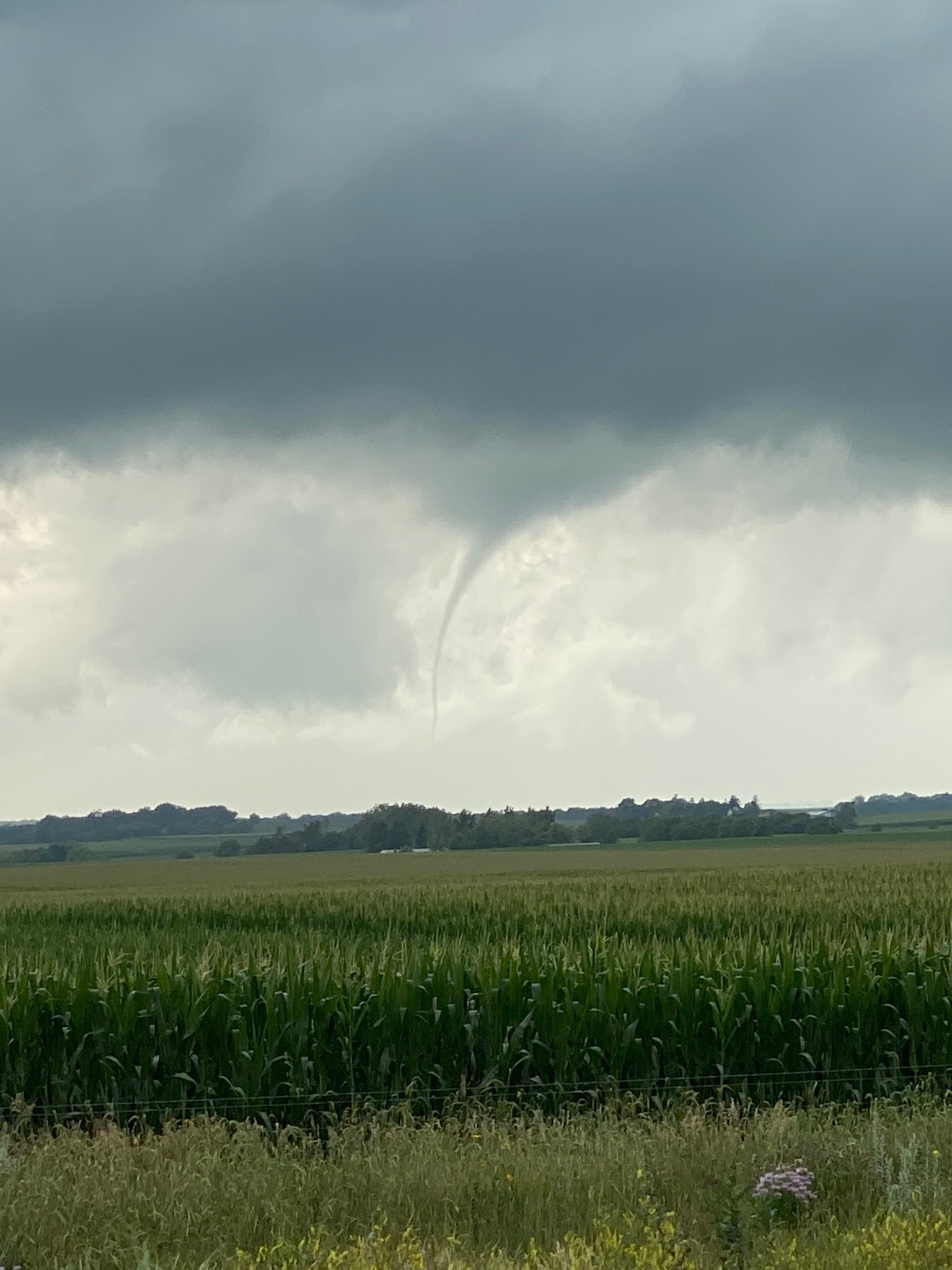
") Jacob Melton (Owosso, MI)
1
Joey Prom (Lafayette, IN)
i was wondering how your chase went
. Actually I got caught up this afternoon. Congrats to all those that scored. I like for you Midwest guys to get a score now and then. Just save some for Ok and Ks
Jacob Melton (Owosso, MI)
1
Joey Prom (Lafayette, IN)
i was wondering how your chase went
. Actually I got caught up this afternoon. Congrats to all those that scored. I like for you Midwest guys to get a score now and then. Just save some for Ok and Ks
")
 (edited)
")
")
")
")


